Loading ...
Loading ...
Loading ...
You can move or hide the Properties palette to expose more of
the drawing area.
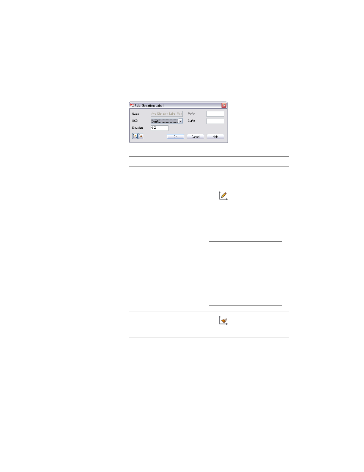
The Add Elevation Label dialog is displayed.
4 Select the coordinate system for the elevation label:
Then…If you want to…
under UCS, select the coordinate
system from the list.
select an existing coordinate system
from the drawing
click (Define UCS), and define
the new UCS on screen. For more
create a new named user coordin-
ate system (UCS)
information about creating user
coordinate systems, see “Use Co-
ordinates and Coordinate Systems”
in AutoCAD help.
TIP The quickest way to locate
and view an AutoCAD topic
referenced in AutoCAD Architec-
ture Help is to click the Search
tab in the Help window, select
the Search titles only option,
and then copy and paste or
type in the AutoCAD topic
name, and click List Topics.
click (Match UCS) and select
the elevation label on screen.
use the UCS of an existing elevation
label
5 Enter the elevation value of your label.
The value you enter here is always calculated in relation to the
coordinate system you have selected. When you redefine the
3436 | Chapter 44 Elevation Labels
Loading ...
Loading ...
Loading ...