Loading ...
Loading ...
Loading ...
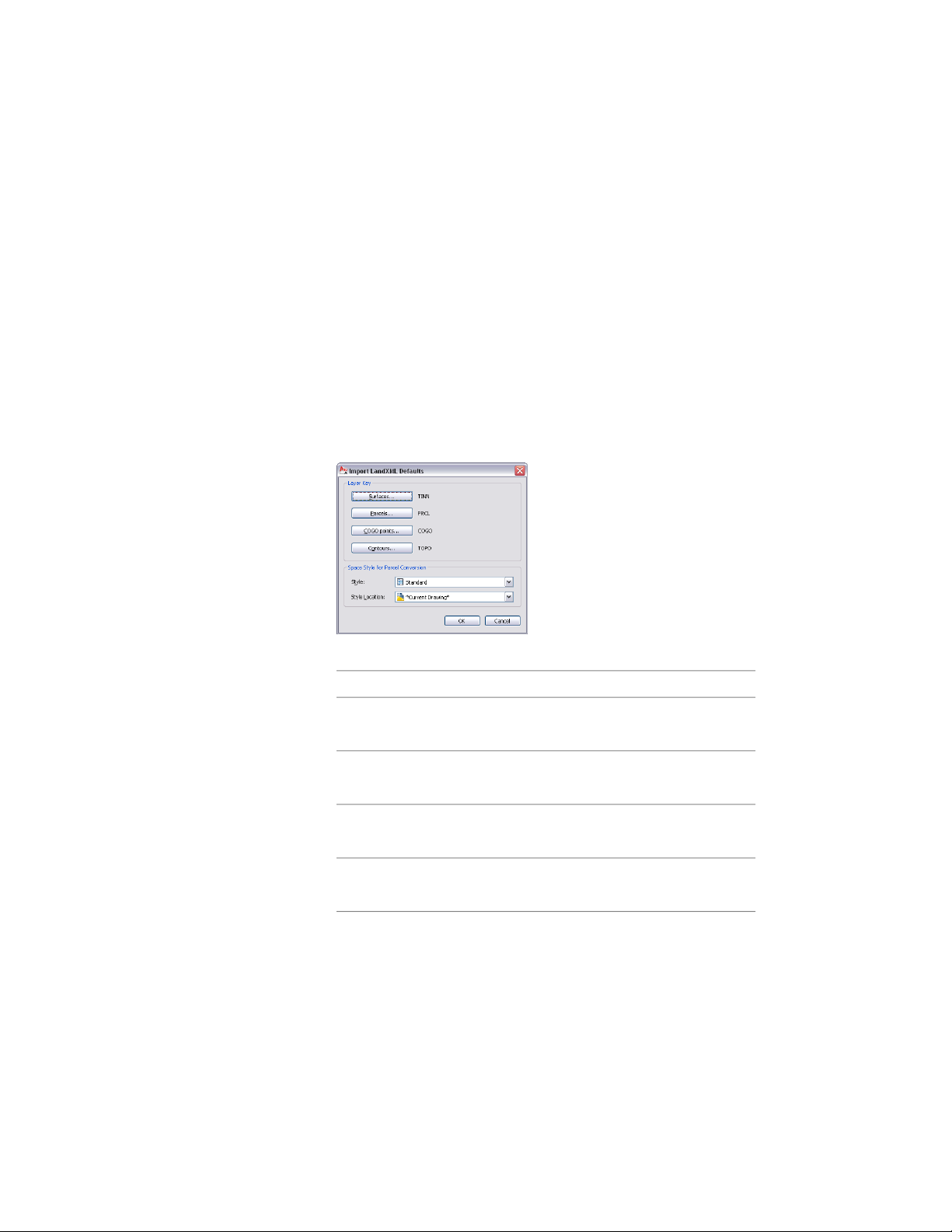
Selecting Layer Keys for LandXML Data
Use this procedure to set a default layer key for the different types of LandXML
data being imported. You can set layer keys individually for COGO points,
parcels, surfaces, and contour lines.
If you do not define specific layer keys for your LandXML data, the imported
data is placed on the default layer keys specified for LandXML data, TINN
(Surfaces), PRCL (Parcels), COGO (COGO Points), and TOPO (Contours).
You can also define a specific space style for parcels that are imported as spaces.
1 Click Insert tab ➤ Import panel ➤ Land XML.
2 Select a LandXML file to import, and click Open.
3 Click Defaults.
4 Select a layer key default for the imported objects.
Then…If you want to…
click Surfaces.select a layer key default for im-
ported surfaces
click Parcels.select a layer key default for im-
ported parcels
click COGO points.select a layer key default for im-
ported COGO points
click Contours.select a layer key default for im-
ported contours
5 Select a layer key, and click OK.
254 | Chapter 5 Interoperability with Other Applications
Loading ...
Loading ...
Loading ...