Loading ...
Loading ...
Loading ...
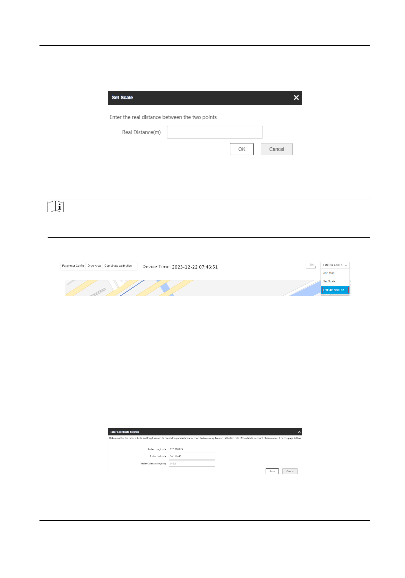
2) Draw a straight line on the map.
3) Enter the actual distance between the two points.
Figure 4-3 Set Map Scale
4) Click OK.
5.
Set the radar longitude and
latude calibraon.
Note
When using latude and longitude calibraon, it is recommended to draw points whose
latudes and longitudes are conrmed on the map in advance.
1) Select Set Scale from the dropdown list.
Figure 4-4 Entrance for Longitude and
Latude Calibraon
2) Click + Add Calibraon Point and click on the map to generate the rst point. Enter the
latude and longitude of this point, accurate to 6 decimal places.
3) Click + Add
Calibraon Point and click on the map to generate the second point. Enter the
latude and longitude of this point, accurate to 6 decimal places.
4) Click Save
Calibraon on the top right corner.
5) Enter the radar latude and longitude and orientaon in the popup window.
Radar Orientaon
The radar orientaon is the clockwise angle between the true north direcon and the
radar center line. You can place your mobile phone on the back of the radar and use the
applicaon with compass funcon to get this angle.
Figure 4-5 Radar Coordinate
Sengs
Security Radar User Manual
16
Loading ...
Loading ...
Loading ...