Loading ...
Loading ...
Loading ...
›
Choose the desired waypoint tour, and then select one of the following menu
items.
Store the waypoint tour on the SD card
Delete the waypoint tour
Rename the waypoint tour
Display the waypoint tour » Fig. 231 on page 193
Import waypoint tour from the SD card
▶
In the Waypoint mode main menu, tap on the function surface →
Waypoint
memory
→
Import
.
▶
Select the source of the waypoint tour recording and confirm the import.
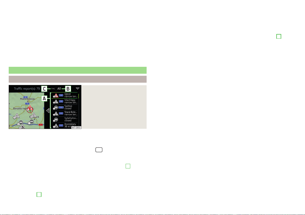
Traffic reports
List of traffic reports
Fig. 232
List of traffic reports
The Infotainment system enables the reception of traffic reports, which in-
clude information regarding traffic congestion, using TMC (Traffic Message
Channel) or online (when Infotainment Online» page 13 services are activated).
›
To display the list of traffic reports, tap on the
sensor field and then tap
the function surface .
In the list of traffic messages and the map, a max. of 6 messages are displayed,
that have a letter and the traffic obstruction symbol (e.g. , , )
A
» Fig. 232.
At present on the route traffic information is taken by using a nav. announce-
ment.
Source of Traffic Information
On the position
C
» Fig. 232 can the following symbols are displayed.
TMC Traffic Information (with strikethrough icon, the Infotainment is out
of range of any traffic information provider)
Online traffic report
Display options
▶
Route guidance is disabled - All traffic messages are displayed.
▶
Route guidance is taking place - After tapping the function surface
B
» Fig. 232 in the displayed menu all traffic messages can be selected by tap-
ping the function surface
All areas
, or by tapping the function surface
route
On-
ly the traffic messages present on the route can be selected.
A traffic report may contain some of the following information.
▶
Symbol of the traffic obstruction
▶
Number of road affected
▶
Name of the location affected
▶
Description of the traffic obstruction
Distinguish the importance of a TMC message traffic obstruction using
colour
The symbol for traffic obstruction (e.g.
,
,
) precedes the obstruction and
the length of the obstruction is shown in the map on the right along the route.
Depending on the context, the symbol for the obstruction is displayed in one
of the following ways.
No route guidance is taking place
▶
Red - All traffic obstructions
Route guidance is not taking place
▶
Grey - The traffic obstruction is not on the route
▶
Red - The traffic obstruction is on the route, the route will not be recalcula-
ted and the route passes through the traffic obstruction
▶
Orange - The traffic obstruction is on the route, the route is recalculated and
an alternative route is available
Distinguish the importance of a TMC message traffic obstruction using
colour
The colour differentiation of traffic conditions on the provider of the online
traffic reports depends.
to Change the map orientation From the main menu Navigation the function
surface →
Map
→
Traffic flow settings
.
194
Infotainment
Loading ...
Loading ...
Loading ...