Loading ...
Loading ...
Loading ...
The map is in the 2D display.
The map is centred (the function surface is hidden).
The map scale is max. 10 km.
With a map scale greater than 10 km, the map is automatically oriented to-
wards north.
You can only change the map orientation in the 2D display, provided the map is
centred on the vehicle position (the function surface is hidden » page 156,
Map centring).
With a map scale greater than 10 km, the map is automatically oriented to-
wards north.
›
To change the map orientation, go to the main Navigation menu and tap on
function surface
A
» Fig. 197.
The map is oriented to the north
The symbol
for the vehicle position rotates, the map and the polar star sym-
bol
do not rotate.
Map oriented to the direction of travel
The map and the Polar Star symbol
rotate, the vehicle position symbol
does not rotate.
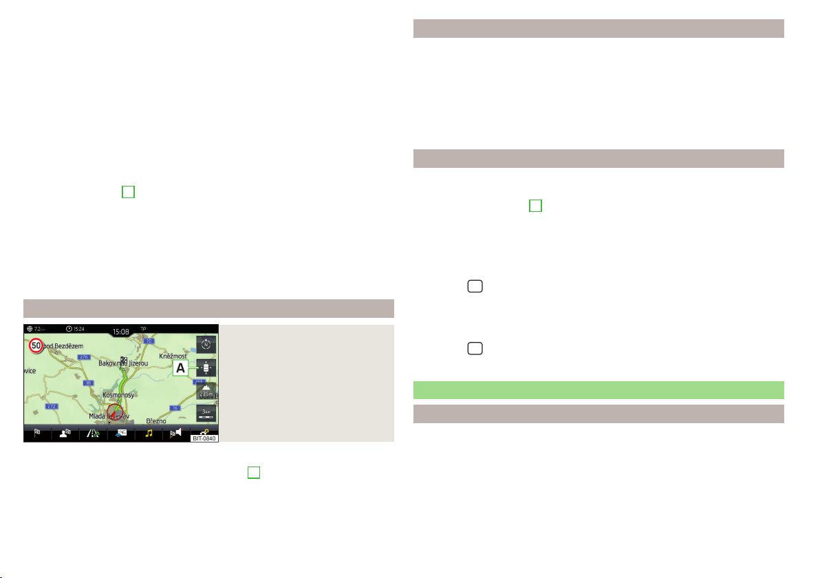
Map centring
Fig. 198
Map centring
The moved map can be centred in the vehicle, destination or route position.
›
To centre the map, tap on function surface
A
» Fig. 198.
POIs display
The Infotainment system offers the possibility of displaying POI symbols on
the map on the Infotainment screen.
›
To activate/deactivate the display, go to the main Navigation menu and tap
on the function surface →
POIs
.
›
To select the POIs to be displayed, go to the main Navigation menu and tap
on the function surface →
Map
→
Select categories for POIs
and select the de-
sired categories (max. 10).
Road sign display
The Infotainment system offers the option of displaying the traffic signs stor-
ed in the navigation data or detected by the front camera during guidance on
the Infotainment screen
G
» Fig. 181 on page 147.
›
To activate/deactivate the road sign display, go to the main Navigation
menu and tap on the function surface
→
Map
→
Show road signs
.
For some vehicles it is possible to set an alert when exceeding the permitted
speed limited by a road sign.
›
Press the
button, then tap on function surface
→
Driver assistance
→
Speed warning:
.
When towing a trailer, we recommend that you activate recognition of road
signs relevant to trailers.
›
Press the
button, then tap on function surface
→
Driver assistance
→
Show
road signs relevant to trailers
.
Route guidance
Introduction to the subject
A route is created by starting route guidance to a destination. Additional stop-
overs can be added to the route.
Route guidance takes place as follows
▶
Through graphical driving instructions on the Infotainment screen and in the
display of the instrument cluster.
▶
Through navigation announcements.
156
Infotainment
Loading ...
Loading ...
Loading ...