Loading ...
Loading ...
Loading ...
©
2021 DJI All Rights Reserved.
37
DJI TERRA
User Manual
Generate 3D Flight Route
Display Result
Modify Result
Flight Route Plan Type
Distance Interval (Auto)
Spraying Type
Continuous Spraying
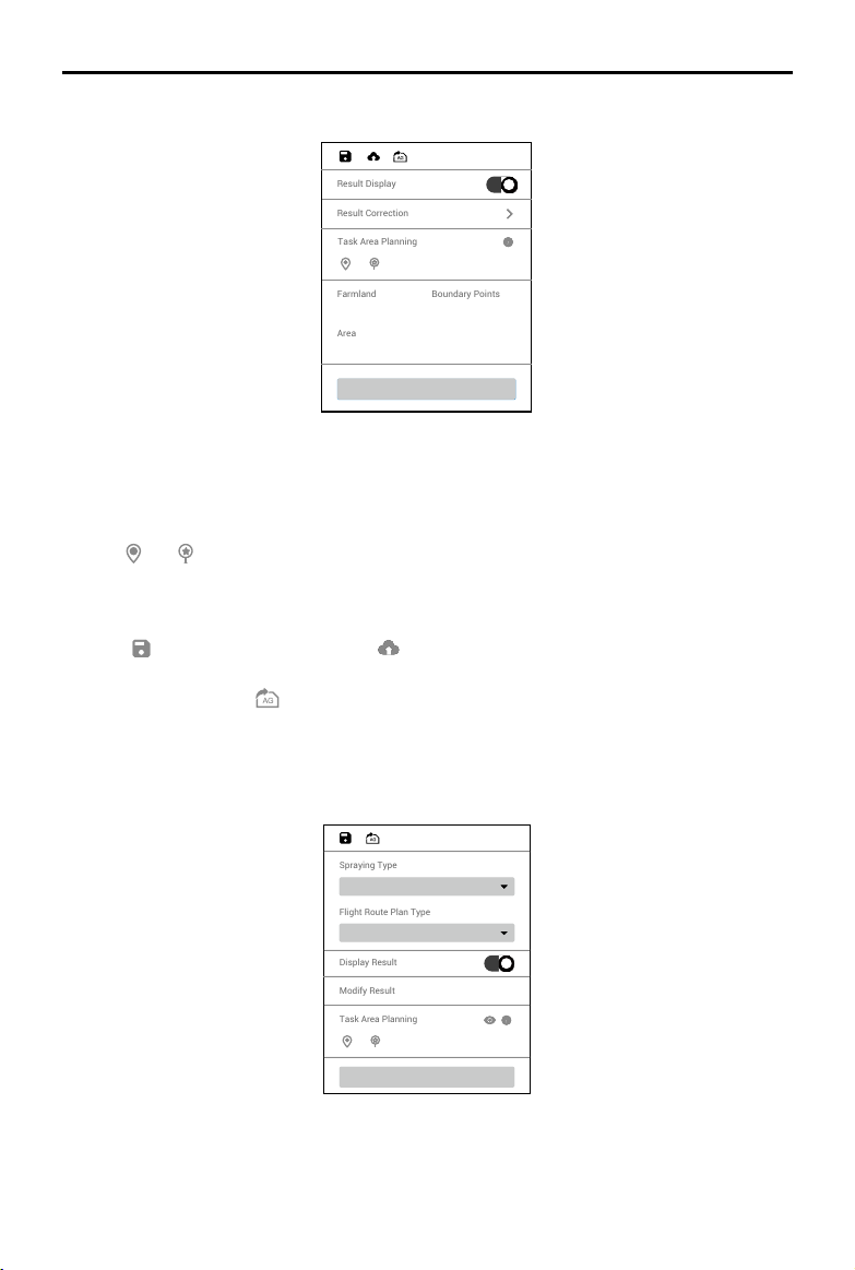
Task Area Planning
Field
Generate Route
Result Display
Result Correction
1
221597.72
6
Farmland
Area
Boundary Points
Generate Route
Task Area Planning
1. If Display Result is enabled, recognition for different areas such as fruit trees, buildings, ground,
water, and poles will be displayed on the map.
2. Click Modify Result to use the corresponding brush for each type of area to paint on the map to
modify the recognition result.
3. Click
and to add boundary points and calibration points in the area that includes elds.
4. Click “Generate Route.” DJI Terra will automatically generate a route for eld operations. Users
can enable or disable route display and obstacle avoidance, and congure altitude, route width,
and route angle.
5. Click
to save the mission. Click and the mission will be uploaded to DJI Agras
Management Platform. Agras aircraft users can download the mission from the platform to the
compatible app. Click
and the mission will be exported to the microSD card in the remote
controller connected to the computer. Insert the card into the Agras remote controller and import
the mission in the pop-up menu in the app.
Fruit Tree
Loading ...
Loading ...
Loading ...