Loading ...
Loading ...
Loading ...
©
2021 DJI All Rights Reserved.
9
DJI TERRA
User Manual
: Export — Click to enter mission managing mode. Choose missions and export them.
The export function here is the same as the one mentioned below in the text about the export
function for a selected mission.
: Manage — Click to enter mission managing mode. Choose missions and delete them.
New Mission: Click to choose a mission type and create a new mission.
Click a mission to select it and:
: Edit — This icon can only be clicked before a mission starts. Click to enter mission editing
mode and set parameters.
: Continue — If a mission is stopped and “Back to Mission List” is chosen in the prompted
menu, this icon will appear when the same mission is selected in the mission library. Click to
choose the next operation from the prompted menu.
: View — This icon will appear after a mission is completed. Click to view the parameters.
NOTE: Parameters cannot be edited.
: Reconstruction — This icon will only appear in Reconstruction missions. The icon will
also appear in Flight Route missions if the reconstruction was created using DJI Terra v2.3.0
or earlier. Click to enter the reconstruction page for 2D map reconstruction or 3D model
reconstruction. For more information, refer to “Reconstruction Missions” on p. 30.
: Copy — Click to create a copy of this mission. The ight path and parameter settings will
be the same.
: Open Folder — Click to open the folder where the current mission is located.
: Delete — Click to delete the mission.
: Export — Click to export the mission with the current settings and its les such as photos,
2D maps, and 3D models. The exported file can be used to create a mission via “Import”.
The mission name of the exported mission is the same as the one in DJI Terra. It will not be
changed when importing it to create a mission even if the exported le’s name is changed.
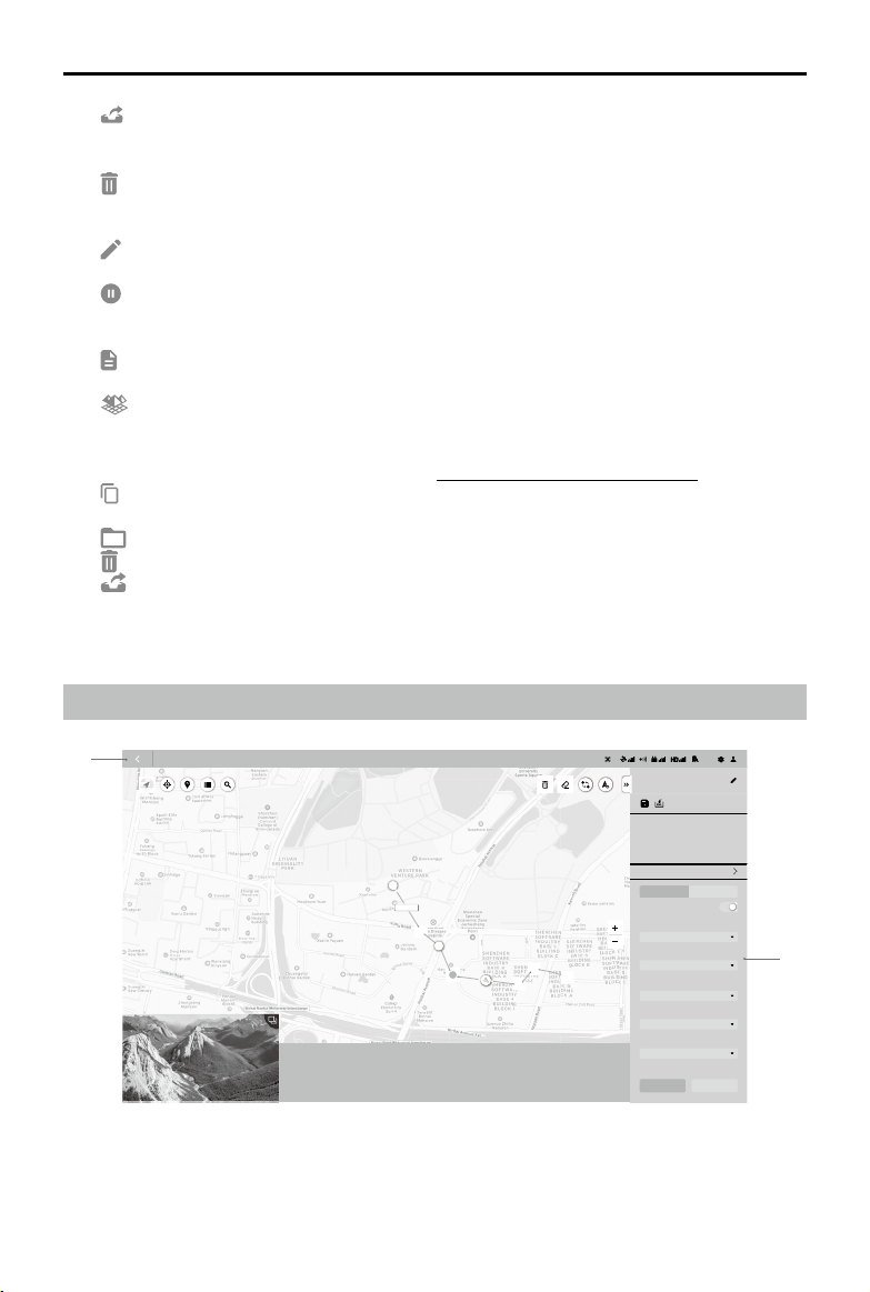
Flight Route Mission Editing View
1. Back
Click to return to the main screen.
S
2
56m
1234m
12m34s
90
100
100%
8BZQPJOUT
12
E
S
10 m/s
1IBOUPN
%%
/"
Route Distance
Waypoint Count Estimated Photo Count
New Waypoint Mission
Fly Safe
Route Settings Waypoint Settings
Coordinated Turn
Ratio
Camera
)PWFS
'PMMPX3PVUF
5JNFE4IPU
Finishing Action
Aircraft Heading
Capture Mode
Start Pause
0000
m
Home Distance
0000
m
Altitude
00.00
m
/s
Speed
00.00
Time
0
Photo Count (Downloaded/Captured)
Estimated Flight Route
Time
1
2
Loading ...
Loading ...
Loading ...