Loading ...
Loading ...
Loading ...
©
2021 DJI All Rights Reserved.
19
DJI TERRA
User Manual
f. Gimbal Pitch: Adjust the gimbal pitch angle on arrival at this waypoint. Pitch angle can range
from -90° to 0°, with downward represented by -90° and forward represented by 0°. If “Gimbal
Pitch Angle” is set as a value in “Waypoint Settings”, the aircraft will y to the waypoint with
the dened Gimbal Pitch Angle then adjust it according to the Gimbal Pitch settings dened
when adding an Action for the current waypoint.
Delete Action: Click
on the right side of the desired action to delete it.
Re-Order: Click and hold
on the left side of the desired action, drag it to the desired position
and release.
DO NOT add Start Recording after Capture. Otherwise recording cannot be started.
DO NOT add Capture after Stop Recording. Otherwise a picture cannot be captured.
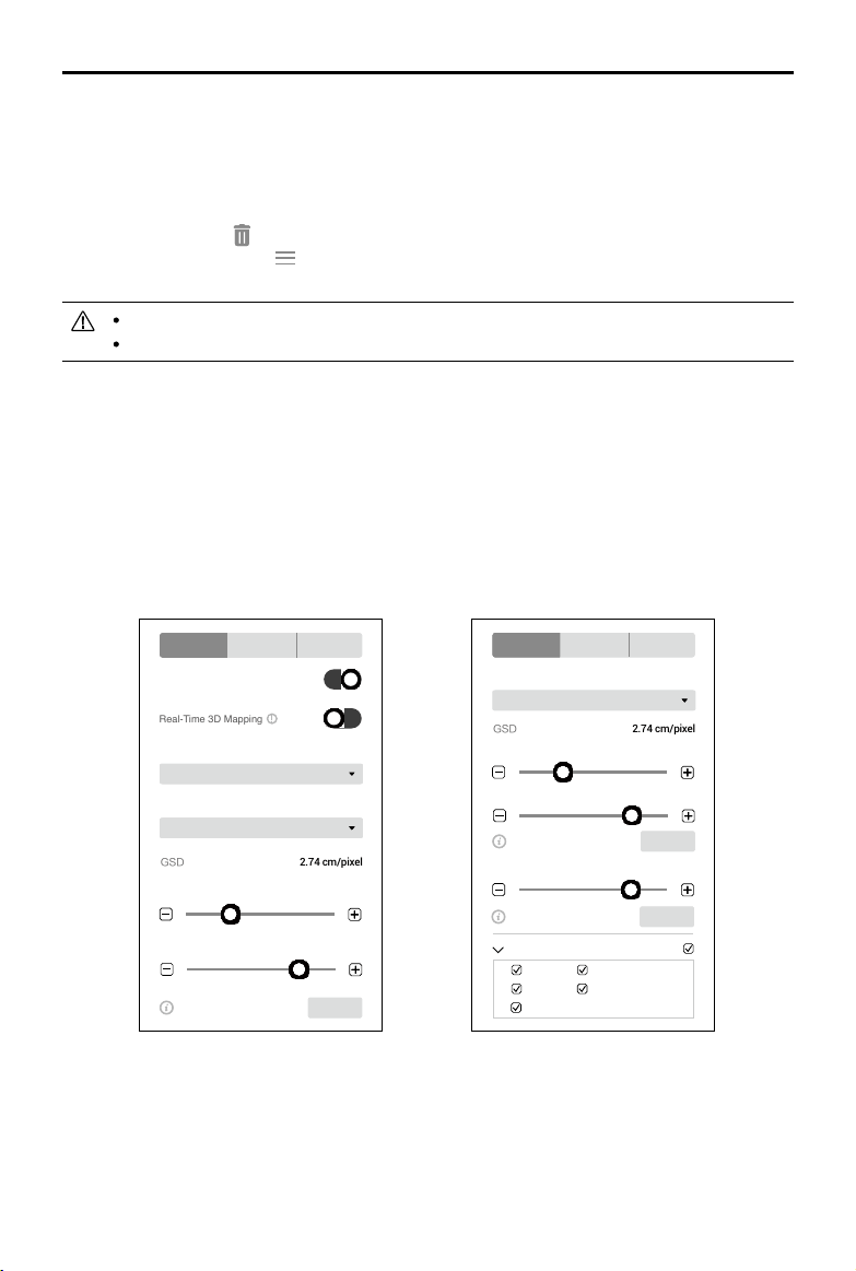
Mapping / Oblique Settings
The settings for Mapping and Oblique missions are similar. Unless otherwise specified, the
descriptions below are compatible with both types of missions.
For Oblique missions, parameters such as overlap ratio and speed can be set separately for the
nadir view ight path and oblique ight paths. During mission settings, click the numbers 1 to 5 in
the map view to preview each ight path. 1 refers to the nadir view ight path, and 2 to 5 refer to the
four oblique ight paths respectively.
Basic Settings
Mapping
Basic Advanced Camera
Real-Time 2D Mapping
Real-Time 3D Mapping
2.74 cm/pixelGSD
Field
Mapping Scenes
Return to Home
Finishing Action
100 m
Mission Altitude
10 m/s
Speed
Max. Speed 13m/s Set
10 m/s
2.74 cm/pixelGSD
Max. Speed 13m/s Set
Max. Speed 13m/s Set
Return to Home
Finishing Action
100 m
Mission Altitude
10 m/s
Speed (Nadir View)
Speed (Oblique)
Basic Advanced Camera
Select Flight Route
Route 1
Route 2
Route 3
Route 5
Route 4
Oblique
Basic Advanced Camera
Real-Time 2D Mapping
Real-Time 3D Mapping
2.74 cm/pixelGSD
Field
Mapping Scenes
Return to Home
Finishing Action
100 m
Mission Altitude
10 m/s
Speed
Max. Speed 13m/s Set
10 m/s
2.74 cm/pixelGSD
Max. Speed 13m/s Set
Max. Speed 13m/s Set
Return to Home
Finishing Action
100 m
Mission Altitude
10 m/s
Speed (Nadir View)
Speed (Oblique)
Basic Advanced Camera
Select Flight Route
Route 1
Route 2
Route 3
Route 5
Route 4
1. Real-Time 2D Mapping (for Mapping only)
If enabled, DJI Terra will process the photos captured during a mission and display the mapping
results on the map in real time. However, the results will be less accurate. Users can import the
original photos into DJI Terra after the mission is complete for mapping with higher accuracy.
If disabled, there will not be any real-time results.
Loading ...
Loading ...
Loading ...