Loading ...
Loading ...
Loading ...
32
©
2021 DJI All Rights Reserved.
DJI TERRA
User Manual
Urban
2D Map
Medium
New 2D Map Mission
Type
Mapping Scenes
Resolution
Annotation and Measurement
Agricultural Application
Add Photo
Start Reconstruction
Mission Library
New Waypoint Mission
Created on: 12/03/2019
Last update: 23/06/2019
New Mission
4. If users want to use the GPS positioning information included in the photos for reconstruction,
remove the PPK result le in the photo folder before importing photos.
5. Refer to the section below for the remaining instructions on reconstruction.
2D Map Reconstruction
Reconstruction Procedure
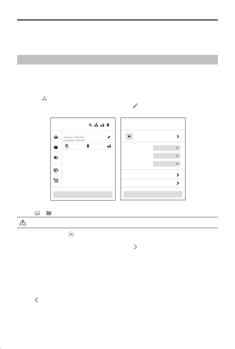
1. Create a mission via the following two methods:
a. Click the “New Mission” button on the lower left corner, choose the mission type, input the
mission name, and then click “OK” to enter Mission Editing mode.
b. Click
in the right section of the mission library to import a mission le from the computer.
Click to select the imported mission and then click
to enter Mission Editing mode.
2. Click
or . Select photos corresponding to the Mapping mission to add photos.
It is recommended to select at least six photos on two main paths for reconstruction.
3. After import, the icon
will appear on the upper right corner of the map view. Click to turn it
blue indicating that capture location display is enabled. The corresponding location of the photos
captured will be displayed on the map as a dot. Click
on the right to manage the photos. The
photos are grouped by the folders they are located. Expand the list to view and manage photos.
If capture location display is enabled, click the name of the photo to turn it blue and the
corresponding dot on the map will turn orange. Similarly, when you click the dot on the map, its
corresponding photo name in the list will turn blue.
Double-click a photo to view in a large size and zoom in or out.
Click “Manage,” select photos and then click “Delete” to delete photos. Click “Cancel” to exit
management.
Click
to return to the reconstruction page.
4. Select “2D Map” as the reconstruction type.
Loading ...
Loading ...
Loading ...