Loading ...
Loading ...
Loading ...
Map and compass
Map and compass overview
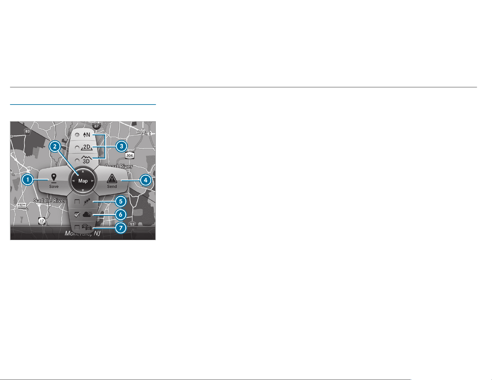
1
Saves the current vehicle position
2
Moves the map
3
Selects the map orientation and map view
4
Selects the function depending on the equip‐
ment:
• Sends a hazard warning via Car-to-X.
• Filters the display of POIs in the vicinity
according to POI category
5
Switches the display of personal POI sym‐
bols on the map on or off
6
Switches one of the following displays on or
off depending on the equipment:
• Weather information
• Satellite map
• Traffic incidents
7
Switches the traffic map display on or off
The map and satellite images are shown in globe
projection. This allows for a realistic map display
in all map scales. The map uses elevation model‐
ing.
Depending on the map data, important buildings
in many cities are depicted realistically on the
map in small map scales (e.g. 1/32 mi (20 m),
1/16 mi (50 m)). Other buildings are shown as
models.
%
You can set the unit of measurement of the
map scale (/ page 269).
If online information is available, fuel prices and
the availability of parking spaces in par king
garages are displayed, for example.
%
Requirements:
R
Mercedes me connect is available.
R
You have a user account for the
Mercedes me portal.
R
The service has been activated at an
authorized Mercedes-Benz Center.
Further information can be found at: http://
www.mercedes.me
%
The online information is not available in all
countries.
If Display in COMAND is activated in Traffic Sign
Assist (/ page 218), speed limits and over‐
taking restrictions are displayed on the map.
296
Multimedia system
Loading ...
Loading ...
Loading ...