Loading ...
Loading ...
Loading ...
48
©
2022 DJI All Rights Reserved.
AGRAS T40/T20 P
Unmanned Aircraft Flight Manual
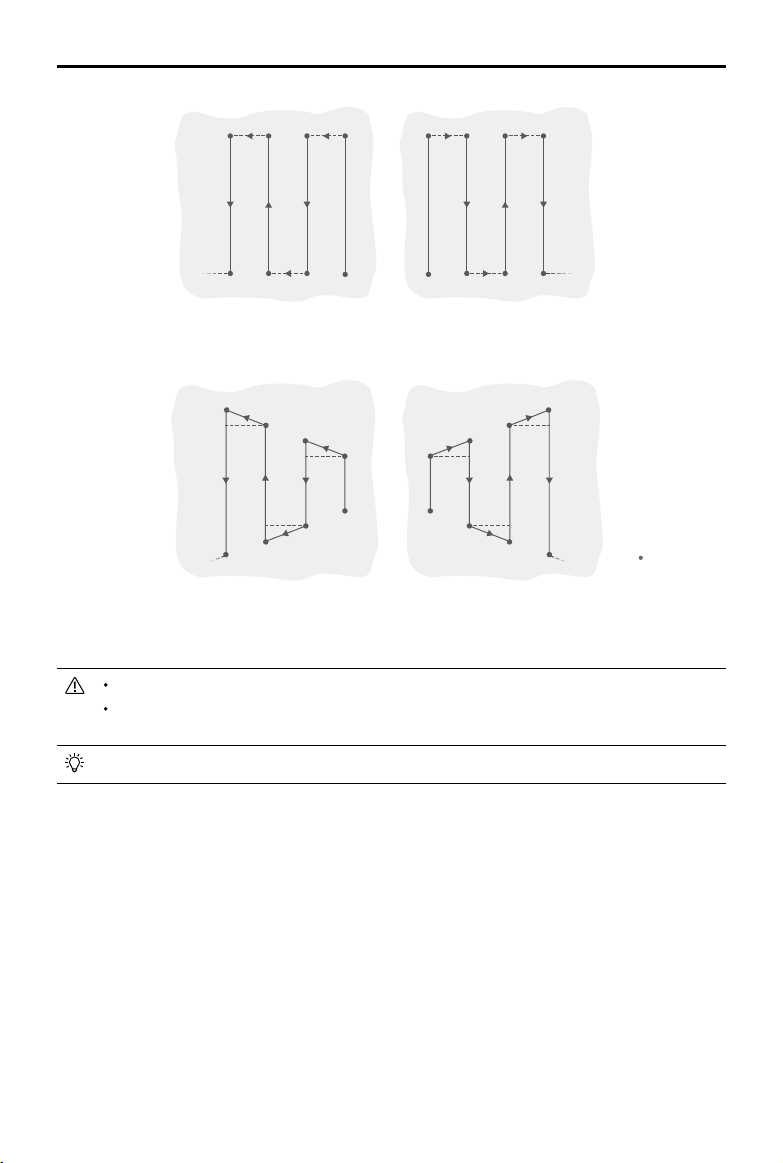
A
B
A
B R1
R2
L1
L2 R3
R4
L3
L4 R5
……
……
R6
L5
L6
Route L
Route R
A
B
A
B
R1’
R2’
L1’
L2’
R3’
R4’
L3’
L4’
R5’
……
……
R6’
L5’
L6’
Route L
’
Route R
’
Legend
- - - -
Route Spacing
Turning Point
Operation Procedure
Maintain VLOS of the aircraft at all times.
Make sure that the GNSS signal is strong. Otherwise, A-B Route operation mode may be
unreliable.
Make sure to inspect operating environments before ying.
Make sure that the GNSS signals are strong and the screen shows Ready to GO (GNSS) or Ready to
GO (RTK).
1. Enter A-B Route Operation Mode
Go to Operation View in the app, tap the mode switch button on the upper left, and select A-B Route.
2. Set the Operation Parameters
In the parameter settings on the left of the screen, users can select a spraying template or set the
spray amount, ight speed, line spacing, and height above the vegetation accordingly.
3. Record Points A and B in Order
Fly the aircraft to the starting point, depicted as Point A or B, hover, and tap Point A or B onscreen or
press the preset customizable button on the remote controller. Point A or B will appear on the map
after it is recorded. If the heading for Point A or B is required to be adjusted, the heading for Point
A should be adjusted after Point A is recorded and then users can record Point B and adjust the
heading for Point B.
Loading ...
Loading ...
Loading ...