Loading ...
Loading ...
Loading ...
©
2022 DJI All Rights Reserved.
33
AGRAS T40/T20 P
Unmanned Aircraft Flight Manual
Max Flight Altitude
Max Radius
Home Point
Altitude of aircraft when powered on or the
distance of the aircraft to the surface
GEO Zone Definitions
Warning Zones:
Users receive a warning message with information relevant to their ight.
Enhanced Warning Zones:
Users receive a prompt from the GEO System at the time of ight. They are
required to conrm their ight path.
Authorization Zones:
Users receive a warning message and the flight is prohibited by default.
Authorization Zones can be unlocked by authorized users with a DJI-veried account. Self-Unlocking
privileges must be applied for online. https://www.dji.com/ysafe
Altitude Zones:
Flights are limited to a specic altitude.
Restricted Zones:
Flights are completely prohibited. UAVs cannot y in these zones. If you have obtained
permission to y in a Restricted Zone, please go to https://www.dji.com/ysafe or contact ysafe@dji.
com to unlock the zone.
DJI GEO Zones aim to ensure the user’s flight safety, but it cannot be guaranteed to be in full
compliance with local laws and regulations. Users should check local laws, regulations, and regulatory
requirements before each ight and are responsible for the ight safety.
All intelligent flight features will be affected when DJI aircraft fly nearby or into GEO Zones. Such
interference includes, but is not limited to, decreased speed, takeoff failure, and ight termination.
Flight Limits
Unmanned aerial vehicle (UAV) operators should abide by the regulations from self-regulatory
organizations such as the International Civil Aviation Organization, the Federal Aviation Administration,
and their local aviation authorities. For safety reasons, ight limits are enabled by default to help users
operate this aircraft safely and legally. Users can set ight limits on height and distance.
When operating with a strong GNSS signal, the height and distance limits and GEO zones work
together to monitor ight. With a weak GNSS signal, only the rmware height limit prevents the aircraft
from going above 100 meters.
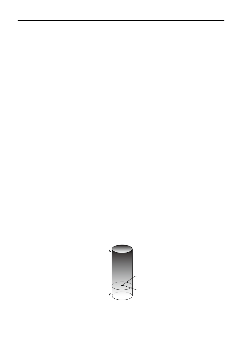
Maximum Height and Radius Limits
Users can change the maximum height and radius limits in the app. Once completed, the aircraft ight
is restricted to a cylindrical area that is determined by these settings. The tables below show the details
of these limits.
Loading ...
Loading ...
Loading ...