Loading ...
Loading ...
Loading ...
DJI FlyCart 30
User Manual
©
2024 DJI All Rights Reserved.
49
Unlocking on a Mobile Device: Run the DJI Pilot 2 app and tap GEO Zone Map on the home
screen. View the list of the unlocking licenses and tap to view details of the unlocking license. A
link to the unlocking license and a QR code will be displayed. Use your mobile device to scan the
QR code and apply to unlock directly from the mobile device.
For more information about unlocking, please visit https://y-safe.dji.com or contact ysafe@
dji.com.
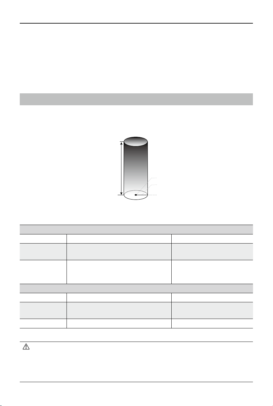
Maximum Altitude & Distance Restrictions
Maximum flight altitude restricts the aircraft flight altitude, while maximum flight distance
restricts the aircraft ight radius around the Home Point. These limits can be set using the DJI
Pilot 2 app for improved ight safety.
Max Distance
Home Point
Height of aircraft when
powered on
Home Point not manually updated during flight
Maximum Altitude
Strong GNSS Signal
Flight Restrictions Prompt in DJI Pilot 2
Max Altitude
Altitude of the aircraft cannot exceed the
value set in DJI Pilot 2.
Aircraft approaching max ight
altitude. Fly with caution.
Max Distance
The straight-line distance from the
aircraft to the Home Point cannot exceed
the max ight distance set in DJI Pilot 2.
Aircraft approaching max ight
distance. Fly with caution.
Weak GNSS Signal
Flight Restrictions Prompt in DJI Pilot 2
Max Altitude
The ight altitude cannot exceed the max
ight altitude set in DJI Pilot 2.
Aircraft approaching max ight
altitude. Fly with caution.
Max Distance No limit N/A
• If an aircraft exceeds a specied limit, the pilot can still control the aircraft but cannot y
any closer to the restricted area.
• For safety reasons, DO NOT y the aircraft close to airports, highways, railway stations,
railway lines, city centers, or other sensitive areas. Only y the aircraft within a visual
line of sight.
Loading ...
Loading ...
Loading ...