Loading ...
Loading ...
Loading ...
©
2017 DJI All Rights Reserved.
37
MATRICE 600 PRO
User Manual
Safe to Fly (GPS) Blinking Green Slowly
Flight Limits DJI GO App
Max Height Flight altitude must be below the preset height. Warning: Height limit reached.
Max Radius Flight distance must be within the max radius. Warning: Distance limit reached.
Safe to Fly (No GPS) Blinking Yellow Slowly
Flight Limits DJI GO App
Max Height
If the Max Flight Altitude set in the DJI GO app
is ≤ 50m*, the ight altitude will not exceed the
preset value.
If the Flight Altitude set in the DJI GO app is >
50m*, the ight altitude will not exceed 50m*.
Warning: Height limit reached.
Max Radius No limit
.
* The value is set to 120 if the aircraft has ever received a strong GPS signal (i.e. at least three white bars are displayed after
the GPS icon) when powered on.
If you y out of bounds, you can still control the Matrice 600 Pro, but cannot y it further.
If the Matrice 600 Pro loses GPS signal and ies out of the max radius but regains GPS
signal afterwards, it will y back within range automatically.
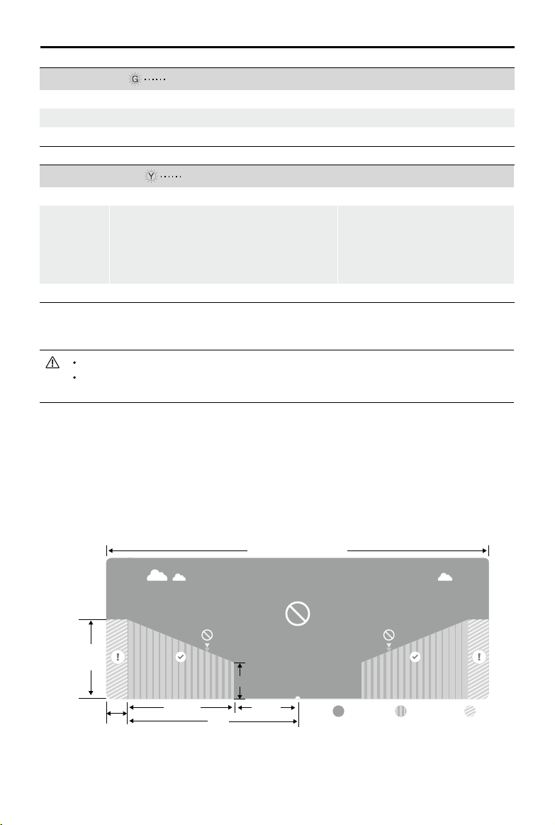
No Fly Zones
All No Fly Zones are listed on the DJI ofcial website at http://ysafe.dji.com/no-y. No Fly Zones are
divided into Airports and Restricted Areas. Airports include major airports and flying fields where
manned aircraft operates at low altitudes. Restricted Areas include borders between countries or
sensitive sites. The details of the No Fly Zones are explained below:
Airports (requires GPS):
Warning Zone Free ZoneNo Fly Zone
Altitude-Restricted Zone Warning ZoneNo Fly Zone
Restricted Areas
R1
66 feet
1 mile
320 feet
R2
100m
R
Airports
1640
feet
1. Airport No Fly Zones are comprised of a no y zone and an altitude-restricted zone. Each type of
zone encompasses a radius of a certain size.
Loading ...
Loading ...
Loading ...