Loading ...
Loading ...
Loading ...
The moved map can be centred/aligned to the vehicle, destination or route po-
sition.
›
To centre the map, tap on function surface
A
» Fig. 235.
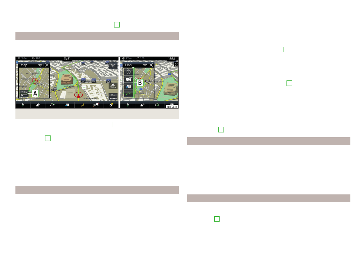
Options for map display in the split screen
Applies to vehicles with Infotainment Columbus, without the digital instrument
cluster.
Fig. 236
Map in split screen
›
In the split screen, tap on function surface
A
» Fig. 236.
Depending on the context, some of the following function surfaces will be dis-
played in area
B
.
Map display with the route from the current vehicle location to the desti-
nation
Change the map orientation
2D - Two-dimensional map display
3D - Three-dimensional map display
Switch on/off the automatic change of scale
Map display options in the digital instrument cluster
Applies to vehicles with Infotainment Columbus, with the digital instrument
cluster.
The ignition must be switched on for the map to be displayed in the digital in-
strument cluster.
Only applies to Infotainment Columbus
The map can be displayed in the digital instrument cluster and in infotainment
at the same time.
The type of map shown in the digital instrument cluster can be selected from
the main menu Navigation in the menu item →
Map
→
Map view in instrum. clus-
ter:
.
The map scale can be adjusted with the dial
A
on the multifunction steering
wheel » page 40,
Applies to Infotainment Amundsen
The map can be displayed in the digital instrument cluster or on the Infotain-
ment display.
▶
To change the display, tap on function surface
B
» Fig. 216 on page 181 in
the main menu Navigation
The type of map shown in the digital instrument cluster is changed via the
main menu Navigation in the menu item
.
The map scale can be changed in one of the following ways.
▶
With the function surfaces in Infotainment » page 189,
▶
By turning the dial
.
▶
With the dial
A
on the multifunctional steering wheel » page 40,
POIs display
The Infotainment system offers the possibility of displaying POI symbols on
the map on the Infotainment screen.
›
To activate/deactivate the display, go to the main Navigation menu and tap
on the function surface
→
POIs
.
›
To select the POIs to be displayed, go to the main Navigation menu and tap
on the function surface →
Map
→
Select categories for POIs
and select the de-
sired categories (max. 10).
Road sign display
Infotainment offers the option of displaying the traffic signs stored in the navi-
gation data or detected by the front camera during guidance on the Infotain-
ment screen
G
» Fig. 217 on page 181.
›
To switch on/off the road sign display in the main menu Navigation, tap on
the function surface →
Map
→
Show road signs
.
191
Navigation
Loading ...
Loading ...
Loading ...