Loading ...
Loading ...
Loading ...
Following Your Route
Your route is marked with a magenta line on the
map. If you depart from the original route, your
route is recalculated. A speed limit icon could
appear as you travel on major roadways.
Adding A Via Point
To add a stop between the current location and
the end destination (Via Point), you must be
navigating a route.
• Press the “back arrow” icon multiple times to
return to the main navigation menu.
• Press the “Where To?” button on the touch-
screen, then search for the additional stop.
Select the destination you wish to add from
the given search results.
• Press the “Go” button on the touchscreen,
then press "Add as a Via Point" button on the
touchscreen and press the "Done" button on
the touchscreen.
Taking A Detour
To take a detour, you must be navigating a route.
• Press the “back arrow” icon button on the
touchscreen multiple times to return to the
main navigation menu.
• Press the “Detour” button on the
touchscreen.
NOTE:
If the route you are currently taking is the only
reasonable option, the device might not calcu-
late a detour.
Acquiring Satellites
The GPS Satellite strength bars indicate the
strength of your satellite reception.
• Acquiring satellite signals can take a few min-
utes. When at least one of the bars is green,
your device has acquired satellite signals.
• You may experience delays receiving satellite
signals when in areas with an obstructed view
to the sky, such as garages, tunnels, or large
cities with tall buildings.
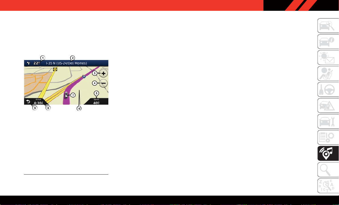
Following Your Route
1 — Distance To Next Turn
2 — Current Location
3 — Zoom In
4 — Zoom Out
5 — Current Speed
6 — Drag Map For Different View
7 — Your Location On The Map
8 — Estimated Time Of Arrival
9 — Navigation Main Menu
187
Loading ...
Loading ...
Loading ...