Loading ...
Loading ...
Loading ...
X:\print\Pioneer\18AVH_H_N\18_Navi_UC_CRI1052(A6_Vertical)_EN\020Chapt
er.fm
AVIC-W8400NEX/AVIC-W6400NEX
18_Navi_UC_CRI1052(A6_Vertical)
English
- 25 -
NOTE
If the data for these items is not contained in the map data, the information is not available even if
there are signs on the actual road.
TIP
When you set [Offer Freeway Services] to on, appears while you are driving on freeways. Touch the
icon to open the details of the next few exits or service stations. In addition, touch an item to show its
location on the map. You can set it as a waypoint easily.
The data fields are different when you are navigating a route and when you have no
specified destination. For example, the data field provides the following information.
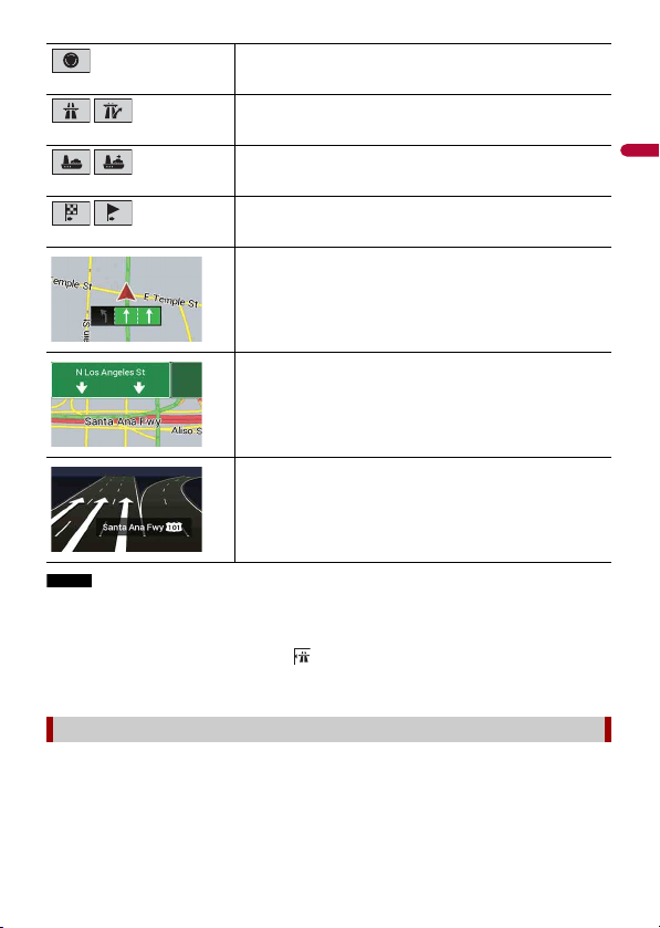
Enter traffic circle (maneuver after the next maneuver).
Freeway entrance or freeway exit.
Board ferry or leave ferry.
Approaching the destination or a waypoint.
Lane information
When navigating on multilane roads, you will need to make sure to
take the proper lane for the recommended route.
Signposts
Signs are displayed at the top of the map.
Junction view
If you are approaching a complex intersection, the map is replaced
with a 3D view of the junction.
Browsing the data field
Loading ...
Loading ...
Loading ...