Loading ...
Loading ...
Loading ...
X:\print\Pioneer\18AVH_H_N\18_Navi_UC_CRI1052(A6_Vertical)_EN\020Chapt
er.fm
AVIC-W8400NEX/AVIC-W6400NEX
18_Navi_UC_CRI1052(A6_Vertical)
English
- 168 -
the screen. If the error message is still
displayed after performing on-screen
instructions, please reconnect the
device.
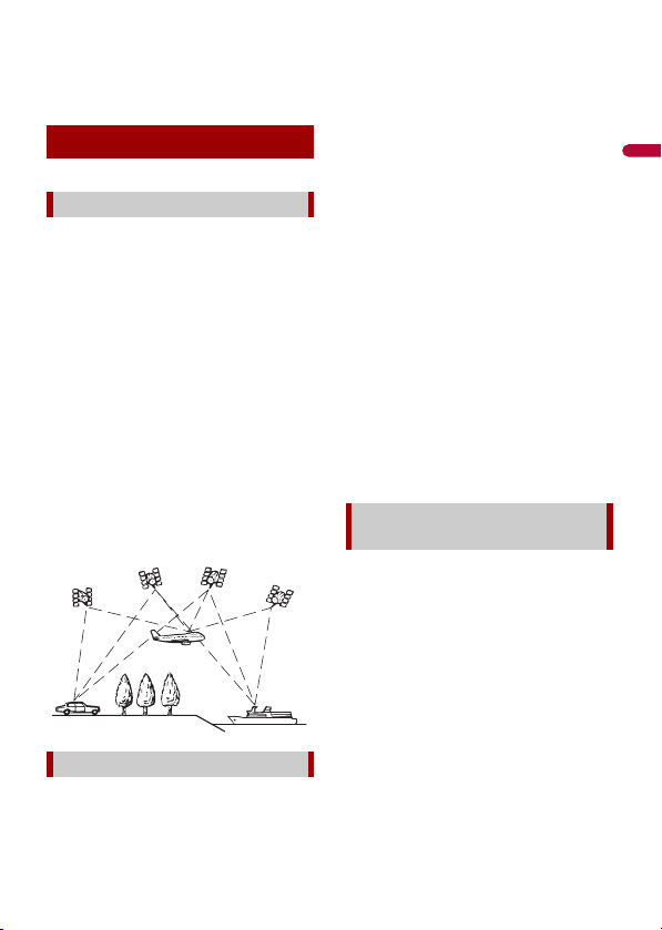
The Global Positioning System (GPS) uses a
network of satellites orbiting the Earth.
Each of the satellites, which orbit at a
height of 68 900 000 feet (21 000 km),
continually broadcasts radio signals giving
time and position information. This
ensures that signals from at least three can
be picked up from any open area on the
ground’s surface.
The accuracy of the GPS information
depends on how good the reception is.
When the signals are strong and reception
is good, GPS can determine latitude,
longitude and altitude for accurate
positioning in three dimensions. But if
signal quality is poor, only two dimensions,
latitude and longitude, can be obtained
and positioning errors are somewhat
greater.
The built-in sensor in the navigation
system also calculates your position. The
current location is measured by detecting
driving distance with the speed pulse, the
turning direction with the gyro sensor and
inclination of the road with the G sensor.
The built-in sensor can even calculate
changes of altitude, and correct the
discrepancies in the distance traveled
caused by driving along winding roads or
up slopes.
If you use this navigation system with
connecting the speed pulse, the system
will become more accurate than no
connection of speed pulse. So you connect
the speed pulse without fail to get the
accuracy of positioning.
• The position of the speed detection
circuit vary depending on the vehicle
model. For details, consult your
authorized Pioneer dealer or an
installation professional.
• Some types of vehicles may not output a
speed signal while driving at just a few
kilometers per hour. In such a case, the
current location of your vehicle may not
be displayed correctly while in traffic
congestion or in a parking lot.
For maximum accuracy, your navigation
system continually compares GPS data
with your estimated position as calculated
from the data of built-in sensor. However, if
only the data from the built-in sensor is
available for a long period, positioning
errors are gradually compounded until the
estimated position becomes unreliable. For
this reason, whenever GPS signals are
available, they are matched with the data
of the built-in sensor and used to correct it
for improved accuracy.
• If you use chains on your wheels for
winter driving or put on the spare wheel,
errors may suddenly increase because of
difference in wheel diameter. Initialize
Positioning technology
Positioning by GPS
Positioning by dead reckoning
How do GPS and dead reckoning
work together?
Loading ...
Loading ...
Loading ...