Loading ...
Loading ...
Loading ...
Navigation System 43
Entering a Destination
After entering the latitude, move the
Interface Dial down and select OK.
The display will change as follows.
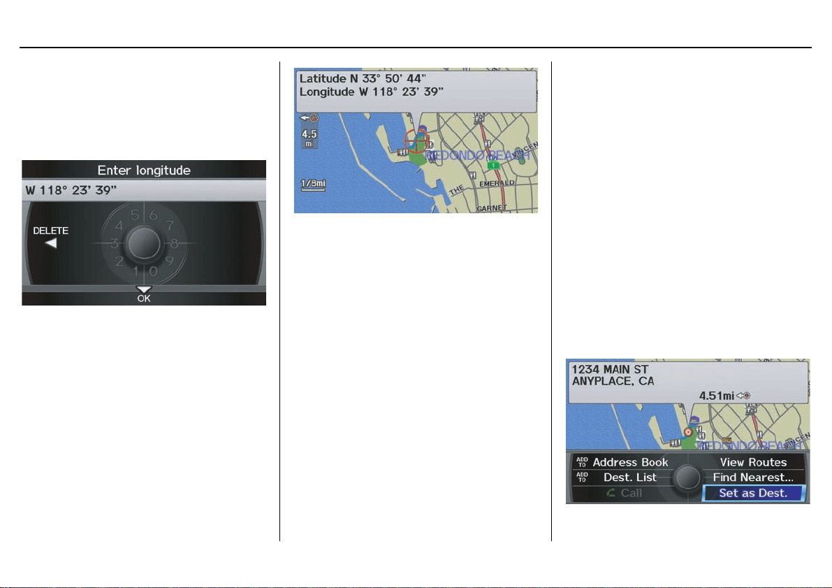
On the Enter longitude screen, use the
Interface Dial to input the longitude.
With the selection of Coordinate, it is
assumed that you are searching for the
destination within the area that is in the
closest proximity. The display will
change as follows.
Move the Interface Dial to find the
desired destination. The map and
crosshairs move in the same direction.
If so desired, you can also rotate the
Interface Dial knob and change the
scale of the map. When the crosshairs
are on the desired icon, map location, or
road, push in on the Interface Dial.
The address for this location will be
displayed at the very top of the screen.
The yellow box (shown in scales above
1/4 mile) denotes the area that can be
viewed with the Interface Dial when
the current map is clicked.
NOTE:
Information icons are displayed at
scales from 1 mile to 1/4 mile, POI icons
are displayed at 1/8 mile or less, and
roads are displayed at 1/4 mile or less.
When you find the desired address,
press on the Interface Dial again. If it
is not the desired address, change the
location of the crosshairs with the
Interface Dial. Push in on the
Interface Dial again to display a new
address.
If you select a section of road within the
crosshairs, the following screen appears.
Select Set as Dest. and calculate the
route for the destination that you
selected.
Loading ...
Loading ...
Loading ...