Loading ...
Loading ...
Loading ...
©2012-2015 DJI. All Rights Reserved. - 32 -
Notices:
Making sure sufficient GPS satellite signal is acquired.
Tips:
Refer to DJI Flight control system User Manual for Manual, Atti., GPS Atti., GPS Cruise switching of your
flight control system, and also the Manual of your R/C Transmitter (Tx).
(V) GO!!
Click Go in the mission Editor, and the aircraft will fly automatically according to the path set in the flight
mission.
Tips:
Using EDIT to re-edit the mission, while a mission is in process. Please click EDIT in mission Editor
to do so. Then the mission editor will return to the state explained in previous section Flight Mission
Setting
Using PAUSE to pause the mission, while a mission is in process. Please click PAUSE, and the
aircraft will slow down and stay hovering. Click CONTINUE and the aircraft will resume the
un-finished mission.
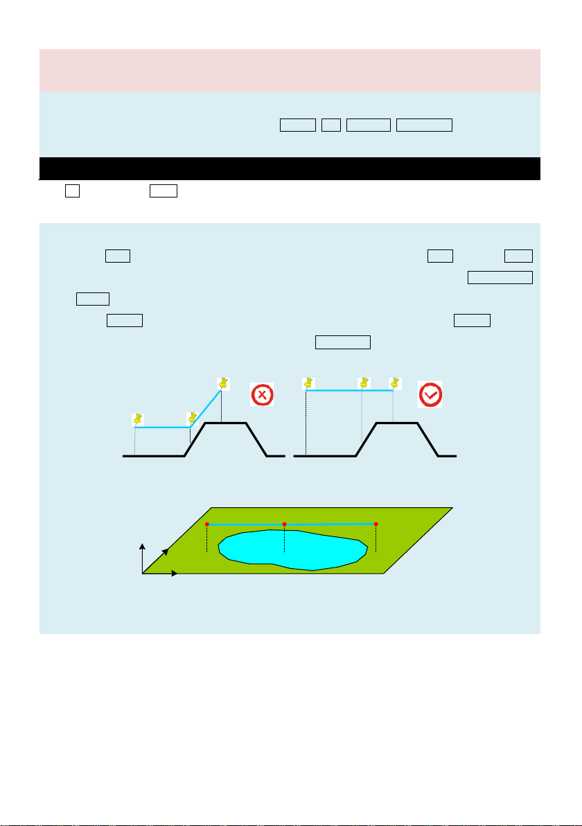
Mountain Mountain
When you set the waypoints for the aircraft to climb a mountain, please make sure that you leave enough
distance between the aircraft and the mountain, in order to avoid collision caused by aircraft air speed.
Latitude
Altitude
Longitude
Please note that when you set a waypoint above water such as lake/sea/river, the default altitude the map
shows will be at the bottom of the water body. Please be careful in setting altitude over water.
Loading ...
Loading ...
Loading ...