Loading ...
Loading ...
Loading ...
©2012-2015 DJI. All Rights Reserved. - 12 -
Target Line: Line between aircraft and current target.
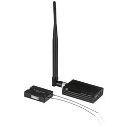
Data Link Setting:
The waypoint number of one package.
Upload one package.
Retry one package timeout.
NetWork Setting:
GS VPN: VPN switch.
ON: If ON is selected, the VPN auto connnect when you launch the GS.
OFF: If OFF is selected, the VPN not auto connect when you launch the GS.
Sys_setAltitude offset: Set up the altitude offset.
Height: Height mode.
Elevation: Elevation mode.
Sys_setData Record Folder: Include both Log and Mission Folders, for saving log files and flight
route files.
4. Language(语言): Click to change language, English or Chinese.
中文.
English.
5. Help:
Check for Update: Update software here.
About: Check your DJI Ground Station version here.
6. Enter location: Go to the location of your input.
7. Fly Trace: Click to show the trace of aircraft.
8. PathExtrude: Click if you want to see flight Path Extrude during mission editing.
9. Map Details: Click to see map details.
10. Instrument Board: Click if you want to display instrument board.
11. Editor: Click if you want to display mission editor.
12. Continue: If you switch into autopilot mode from waypoint mode, click Pause then click Continue,
the aircraft will continue the remaining (Unfinished) mission.
13. Pause: Mission pause.
14. Serial port selection.
15. Connect: Click to connect to main controller.
16. Aircraft: Click to find aircraft location.
17. Real-time coordinates of aircraft, you can copy the data.
18. One Key Takeoff: Click to take off the aircraft.
19. Home Point: Find your home location.
20. Real-time coordinates of home location, you can copy the data.
Loading ...
Loading ...
Loading ...