Loading ...
Loading ...
Loading ...
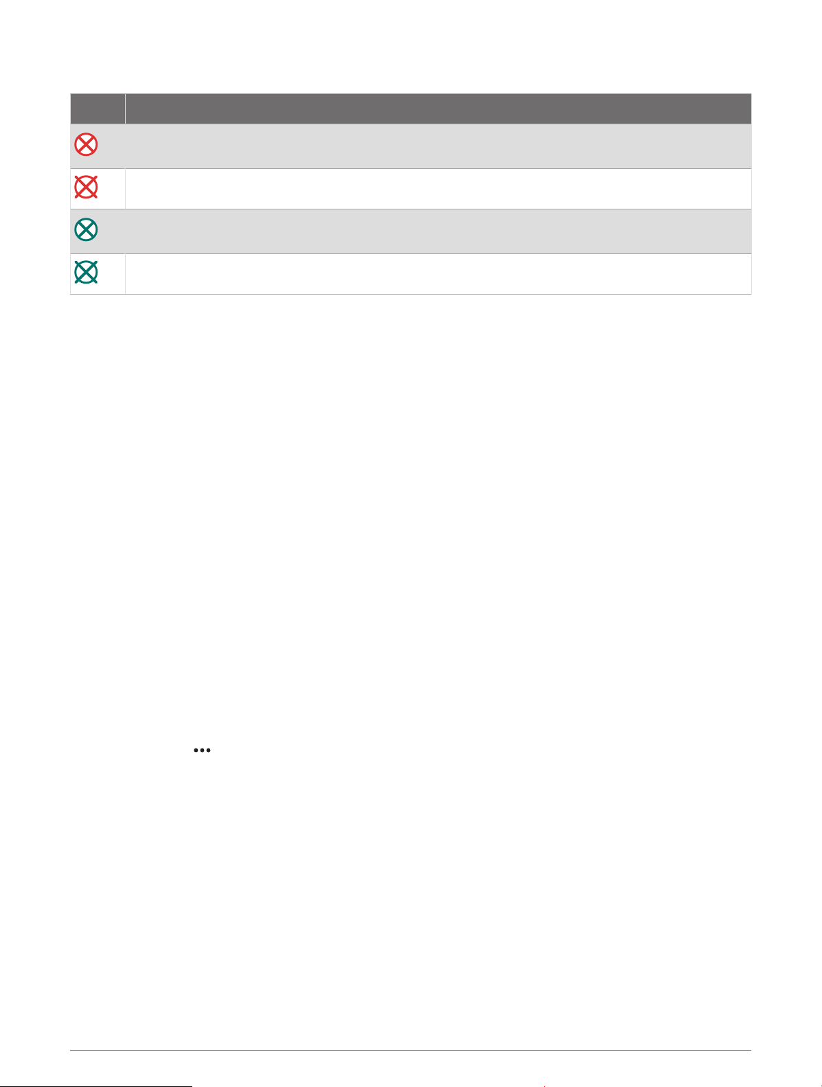
AIS Distress Signal Device Targeting Symbols
Symbol Description
AIS distress signal device transmission. Select to see more information about the transmission and
begin navigation.
Transmission lost.
Transmission test. Appears when a vessel initiates a test of their distress signal device, and does not
represent a true emergency.
Transmission test lost.
Enabling AIS Transmission Test Alerts
To avoid a large number of test alerts and symbols in crowded areas such as marinas, you can select to receive
or ignore AIS test messages. To test an AIS emergency device, you must enable the chartplotter to receive test
alerts.
1 Select Settings > Alarms > AIS.
2 Select an option:
• To receive or ignore Emergency Position Indicating Radio Beacon (EPRIB) test signals, select AIS-EPIRB
Test.
• To receive or ignore Man Overboard (MOB) test signals, select AIS-MOB Test.
• To receive or ignore Search and Rescue Transponder (SART) test signals, select AIS-SART Test.
Turning Off AIS Reception
AIS signal reception is turned on by default.
Select Settings > Other Vessels > AIS > Off.
All AIS functionality on all charts and 3D chart views is disabled. This includes AIS vessel targeting and
tracking, collision alarms that result from AIS vessel targeting and tracking, and the display of information
about AIS vessels.
Chart Menu
NOTE: Not all settings apply to all charts. Some options require premium maps or connected accessories, such
as radar.
NOTE: The menus may contain some settings that are not supported by your installed charts or your present
location. If you make changes to those settings, the changes will not impact the chart view.
From a chart, select .
Layers: Adjusts the appearance of the different items on the charts (Chart Layers, page27).
Quickdraw Contours: Turns on bottom contour drawing, and allows you to create fishing map labels (Garmin
Quickdraw Contours Mapping, page32).
Settings: Adjusts the chart settings (Chart Settings, page31).
Edit Overlays: Adjusts the data shown on the screen (Customizing the Data Overlays, page9).
26 Charts and 3D Chart Views
Loading ...
Loading ...
Loading ...