Loading ...
Loading ...
Loading ...

Clearing All of the Messages
Select > Warning Manager > Clear Warning Manager.
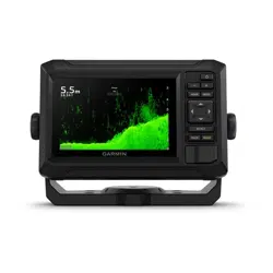
Device Configuration
System Settings
Select > System.
Sounds and Display: Adjusts the display settings and the audio settings (if available).
Satellite Positioning: Provides information about the GPS satellites and settings.
System Information: Provides information about the devices on the network and the software version.
Auto Power Up: Controls which devices turn on automatically when power is applied.
Auto Power Off: Automatically turns off the system after it has been asleep for the selected length of time.
Simulator: Turns the simulator on or off and allows you to set the time, date, speed, and simulated location.
Sounds and Display Settings
Select > System > Sounds and Display.
Beeper: Turns on and off the tone that sounds for alarms and selections.
Audio Setup: Sets up the audio output.
Backlight: Sets the backlight brightness. You can select the Auto option to adjust the backlight brightness
automatically based on the ambient light.
Color Mode: Sets the device to display day or night colors. You can select the Auto option to allow the device to
set day or night colors automatically based on the time of day.
Startup Image: Sets the image that appears when you turn on the device.
Startup Layout: Sets the layout that appears when you turn on the device.
Satellite Positioning (GPS) Settings
Select > System > Satellite Positioning.
Skyview: Shows the relative position of GPS satellites in the sky.
GLONASS: Turns on or off GLONASS data (Russia satellite system). When the system is used in situations with
poor sky visibility, GLONASS data can be used in combination with GPS to provide more accurate position
information.
WAAS/EGNOS: Turns on or off WAAS data (in North America) or EGNOS data (in Europe), which can provide
more-accurate GPS position information. When using WAAS or EGNOS data, the device may take longer to
acquire satellites.
Galileo: Turns on or off Galileo data (European Union satellite system). When the system is used in situations
with poor sky visibility, Galileo data can be used in combination with GPS to provide more accurate position
information.
Speed Filter: Averages the speed of your vessel over a short period of time for smoother speed values.
Source: Allows you to select the preferred source for GPS data.
Viewing System Sofware Information
You can view the software version, the basemap version, all supplemental map information (if applicable), and
the unit ID number. You may need this information to update the system software or to purchase additional map
data information.
Select > System > System Information > Software Information.
Viewing the Event Log
The event log shows a list of system events.
Select > System > System Information > Event Log.
58 Device Configuration
Loading ...
Loading ...
Loading ...