Loading ...
Loading ...
Loading ...

Charts and 3D Chart Views
The charts and 3D chart views that are available depend on the map data and accessories used.
NOTE: 3D chart views are available with premium charts, in some areas.
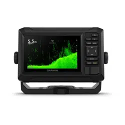
You can access the charts and 3D chart views by selecting Charts.
Nav. Chart: Shows navigation data available on your pre-loaded maps and from supplemental maps, if available.
The data includes buoys, lights, cables, depth soundings, marinas, and tide stations in an overhead view.
Fishing Chart: Provides a detailed view of the bottom contours and depth soundings on the chart. This
chart removes navigational data from the chart, provides detailed bathymetric data, and enhances bottom
contours for depth recognition. This chart is best for offshore deep-sea fishing.
NOTE: The Fishing chart is available with premium charts, in some areas.
Perspective 3D: Provides a view from above and behind the boat (according to your course) and provides a
visual navigation aid. This view is helpful when navigating tricky shoals, reefs, bridges, or channels, and is
beneficial when trying to identify entry and exit routes in unfamiliar harbors or anchorages.
3D Chart: Shows a detailed, three-dimensional view from above and behind the boat (according to your course)
and provides a visual navigation aid. This view is helpful when navigating tricky shoals, reefs, bridges, or
channels, and when trying to identify entry and exit routes in unfamiliar harbors or anchorages.
Fish Eye 3D: Provides an underwater view that visually represents the sea floor according to the chart
information. When a sonar transducer is connected, suspended targets (such as fish) are indicated by red,
green, and yellow spheres. Red indicates the largest targets and green indicates the smallest.
Relief Shading: Provides high resolution elevation shading of lakes and coastal waters. This chart can be
helpful for fishing and diving.
NOTE: The Relief Shading chart is available with premium charts, in some areas.
Detailed Charts
This chartplotter is compatible with the latest Garmin Navionics+
™
cartography and additional premium chart
features. You can obtain these charts in three ways:
• You can purchase a chartplotter with preloaded detailed charts.
• You can purchase chart regions on a memory card from your Garmin dealer or from garmin.com.
• You can purchase chart regions in the ActiveCaptain app, and download them to your chartplotter.
NOTE: You must activate preloaded charts and charts purchased on a memory card using the ActiveCaptain
app before you can access the full chart features on your chartplotter.
Activating a Marine Chart Subscription
Before you can use the full features of Garmin Navionics+ charts that are preloaded on your device or
purchased on a memory card, you must activate your subscription using the ActiveCaptain app.
Your subscription allows you to access the latest chart updates and additional content included with your
purchase.
1 If you purchased charts on a memory card, insert the card into a memory card slot on the chartplotter or
Garmin memory card reader.
2 Open the ActiveCaptain app on your mobile device, and connect it to the chartplotter (Getting Started with the
ActiveCaptain App, page9).
3 After the ActiveCaptain app connects to the chartplotter, make sure your mobile device is connected to the
internet.
4 In the ActiveCaptain app, select Chart > > My Charts, and verify that an active subscription for the charts
is shown in the list.
5 If necessary, connect the ActiveCaptain app to the chartplotter to complete the activation process.
The ActiveCaptain app activates the subscription automatically after it connects to the internet and then to
the chartplotter. The ActiveCaptain app shows the subscription status in the My Charts list.
NOTE: It might take a few hours to verify the new subscription.
Charts and 3D Chart Views 13
Loading ...
Loading ...
Loading ...