Loading ...
Loading ...
Loading ...
DJI Mavic 3E/3T User Manual
70
©
2022 DJI All Rights Reserved.
Annotation Management and Synchronization
PinPoint
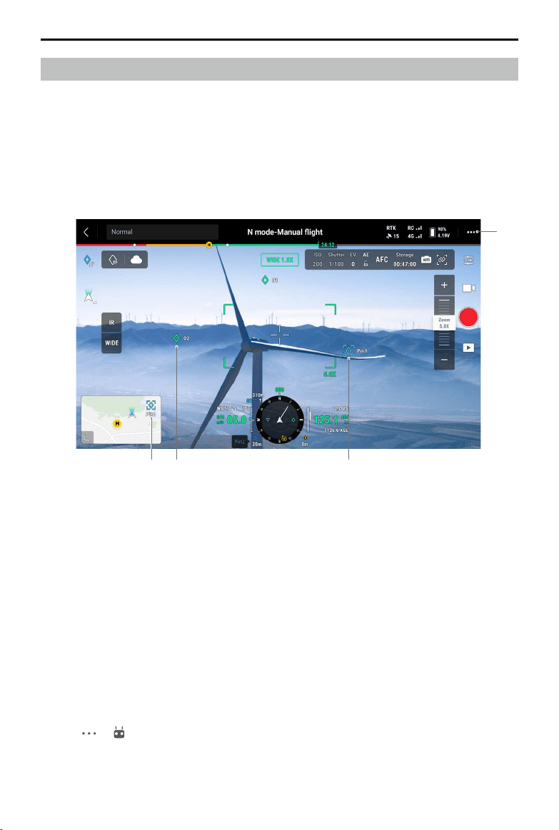
For quick observation and information synchronization, PinPoint can be used to mark the
aircraft location in the camera view or the center point of the map in the map view.
Steps to create a PinPoint in the camera view: adjust aircraft location, tap the PinPoint icon
on the left side of the screen. PinPoint can be set based on the current aircraft location and
includes the latitude, longitude, and altitude of the aircraft.
1. AR projection will be created for the PinPoint in the camera view. PinPoint size will be
adjusted according to the distance between the aircraft and the PinPoint (big when near,
small when far).
2. Selected PinPoint:
a. A small frame will appear around the PinPoint, indicating it is selected.
b. The lower left corner of the Navigation Display shows the horizontal distance from
the PinPoint to the aircraft and the name of the PinPoint. The orientation of the
PinPoint relative to the aircraft is also shown within Navigation Display.
c. If the selected PinPoint is outside the video transmission view, the PinPoint icon will
stay on the edge of the screen, indicating the PinPoint orientation relative to the
center of the view.
d. After selecting a PinPoint, the user can edit the name, color, latitude, longitude, and
altitude of the PinPoint or drag the PinPoint on the map.
3. Tap
-> to set functions of customizable buttons of the remote controller as add
PinPoint, delete the selected PinPoint, or select the previous or next PinPoint. Users can
quickly add and select PinPoints by pressing the buttons.
3
214
Loading ...
Loading ...
Loading ...