Loading ...
Loading ...
Loading ...
This control is best used for situations when you want to control and suppress clutter or noise near the water
surface. It also allows for the display of targets near the surface that are otherwise hidden or masked by
surface noise.
Overlay Number Settings
You can customize the data shown on the sonar screen.
From a sonar screen, select > Overlay Numbers.
Navigation Inset: Shows the navigation inset when the vessel is navigating to a destination.
Compass Tape: Shows the compass tape data bar.
Device Voltage: Shows the voltage of the device.
Depth: Shows the transducer's current depth.
Speed: Shows the vessel's current speed.
Water Temp.: Shows the current water temperature.
Time of Day: Shows the current time of day.
Garmin Quickdraw Contours Mapping
WARNING
The Garmin Quickdraw Contours mapping feature allows users to generate maps. Garmin makes no
representations about the accuracy, reliability, completeness or timeliness of the maps generated by third
parties. Any use or reliance on the maps generated by third parties is at your own risk.
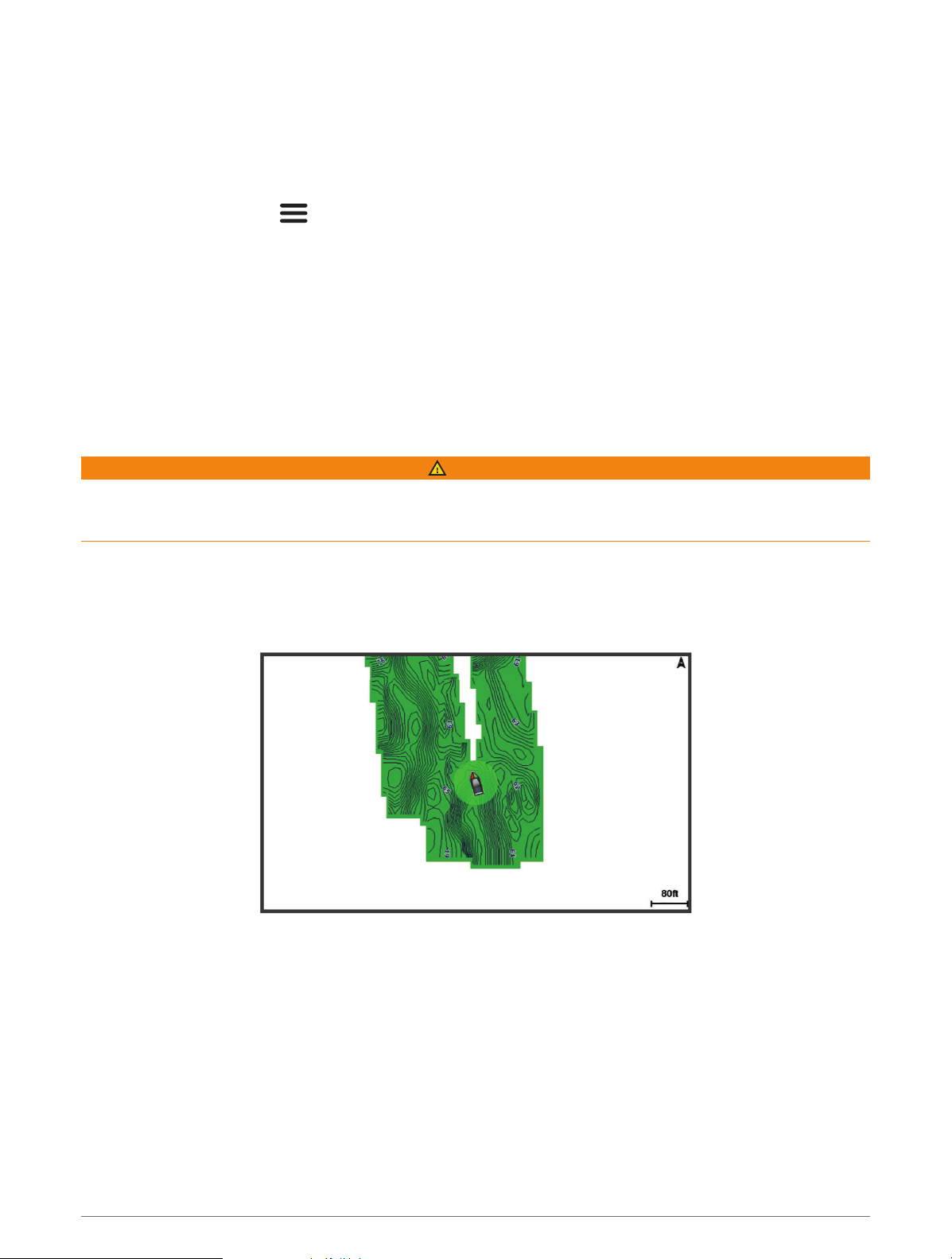
The Garmin Quickdraw Contours mapping feature allows you to instantly create maps with contours and depth
labels for any body of water.
When Garmin Quickdraw Contours records data, a colored circle surrounds the vessel icon. This circle
represents the approximate area of the map that is scanned by each pass.
A green circle indicates good depth and GPS position, and a speed under 16 km/h (10 mph). A yellow circle
indicates good depth and GPS position, and a speed between 16 and 32 km/h (10 and 20 mph). A red circle
indicates poor depth or GPS position, and a speed above 32 km/h (20 mph).
You can view Garmin Quickdraw Contours in a combination screen or as a single view on the map.
The amount of saved data depends on the memory available in the device, your sonar source, and the speed of
your boat as you record data. You can record longer when you use a single-beam sonar. It is estimated that you
might be able to record about 1,500 hours of data onto the device.
Garmin Quickdraw Contours Mapping 17
Loading ...
Loading ...
Loading ...