Loading ...
Loading ...
Loading ...
Flight
54
©
2020 DJI All Rights Reserved.
Flight
Once pre-ight preparation is complete, it is recommended that you use the ight simulator in the DJI GO
4 app to hone your ight skills and practice ying safely. Ensure that all ights are carried out in an open
area.
Flight Environment Requirements
1. Do not use the aircraft in severe weather conditions. These include wind speeds exceeding 10 m/s ,
snow, rain and fog.
2. Only y in open areas. Tall structures and large metal structures may affect the accuracy of the on-
board compass and GPS system.
3. Avoid obstacles, crowds, high voltage power lines, trees, and bodies of water.
4. Minimize interference by avoiding areas with high levels of electromagnetism, including base stations
and radio transmission towers.
5. Aircraft and battery performance is subject to environmental factors such as air density and temperature.
Be very careful when ying at altitudes greater than 19, 685 feet (6000 meters) above sea level, as the
performance of the battery and aircraft may be affected.
6. The Phantom 4 Pro / Pro+ cannot operate within the polar areas.
Flight Limits and GEO Zones
All unmanned aerial vehicle (UAV) operators should abide by all regulations set forth by government and
regulatory agencies including the ICAO and the FAA. For safety reasons, ights are limited by default,
which helps users operate this product safely and legally. Flight limitations include height limits, distance
limits, and GEO zones.
When operating in P-mode, height limits, distance limits, and GEO zones function concurrently to manage
ight safety. In A-mode, only height limits are in effect, which by default prevent the aircraft altitude from
exceeding 1640 feet (500 m) .
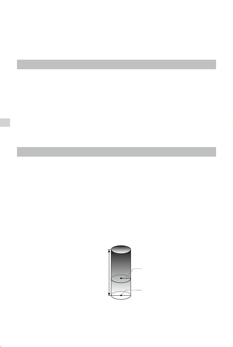
Maximum ight altitude & Radius Limits
Maximum flight altitude and radius limits may be changed in the DJI GO 4 app. Be aware that the
maximum ight altitude cannot exceed 1640 feet (500 meters). In accordance with these settings, your
Phantom 4 Pro / Pro+ will y in a restricted cylinder, as shown below:
Max Flight Altitude
Max Radius
Home Point
Height of aircraft
when turned on
Loading ...
Loading ...
Loading ...