Loading ...
Loading ...
Loading ...
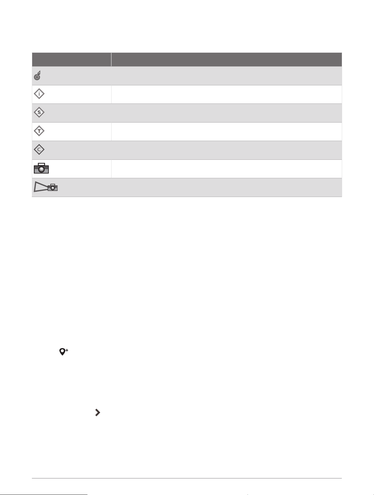
Chart Symbols
This table contains some of the common symbols you might see on the detailed charts.
Icon Description
Buoy
Information
Marine services
Tide station
Current station
Overhead photo available
Perspective photo available
Other features common to most charts include depth contour lines, intertidal zones, spot soundings (as
depicted on the original paper chart), navigational aids and symbols, obstructions, and cable areas.
Zooming In and Out Using the Touchscreen
You can quickly zoom in and out of many screens, such as the charts and sonar views.
• Pinch two fingers together to zoom out.
• Spread two fingers apart to zoom in.
Measuring a Distance on the Chart
1 From a chart, select a location.
2 Select Measure.
A push pin appears on the screen at your present location. The distance and angle from the pin is listed in
the corner.
TIP: To reset the pin and measure from the current location of the cursor, select Set Reference.
Creating a Waypoint on the Chart
1 From a chart, select a location or object.
2 Select .
Viewing Location and Object Information on a Chart
You can view information, such as tide, current, celestial, chart notes, or local services, about a location or an
object on the Navigation chart or the Fishing chart.
1 From the Navigation chart or Fishing chart, select a location or object.
A list of options appears. The options that appear vary based on the location or object you selected.
2 If necessary, select .
3 Select Information.
Charts and 3D Chart Views 17
Loading ...
Loading ...
Loading ...