Loading ...
Loading ...
Loading ...
DJI Mavic 3E/3T User Manual
81
©
2022 DJI All Rights Reserved.
Linear Task
Linear task is used to collect orthophoto for strip-shaped areas such as rivers, pipelines,
and roads. The mapping area can be generated by selecting the center line of the strip and
extending outward along this line.
First, set Flight Band by selecting points on the map to generate the band-shaped mapping
area, and confirm the center line and the scope of the mapping area. Switch to Flight
Route to generate the corresponding s-shaped route, and adjust the route parameters to
complete the setting.
Center line can be generated by tapping on the map or importing a linear KML file. Note:
after the band-shaped area is generated, check along the path to see if there is a large
deviation from the original mapping area. If there is a deviation, increase some points to
cover the area completely or increase the length of the left and right extensions to cover the
mapping area completely.
Collecting Aerial Photogrammetry Data
The collection of aerial photogrammetry data can be achieved using three flight tasks:
Mapping, Oblique, and Linear. The following takes the Mapping task as an example for
specific operation instructions.
Before collecting aerial photogrammetry data, enter the aircraft settings to enable RTK,
and ensure that RTK is connected and in FIX state.
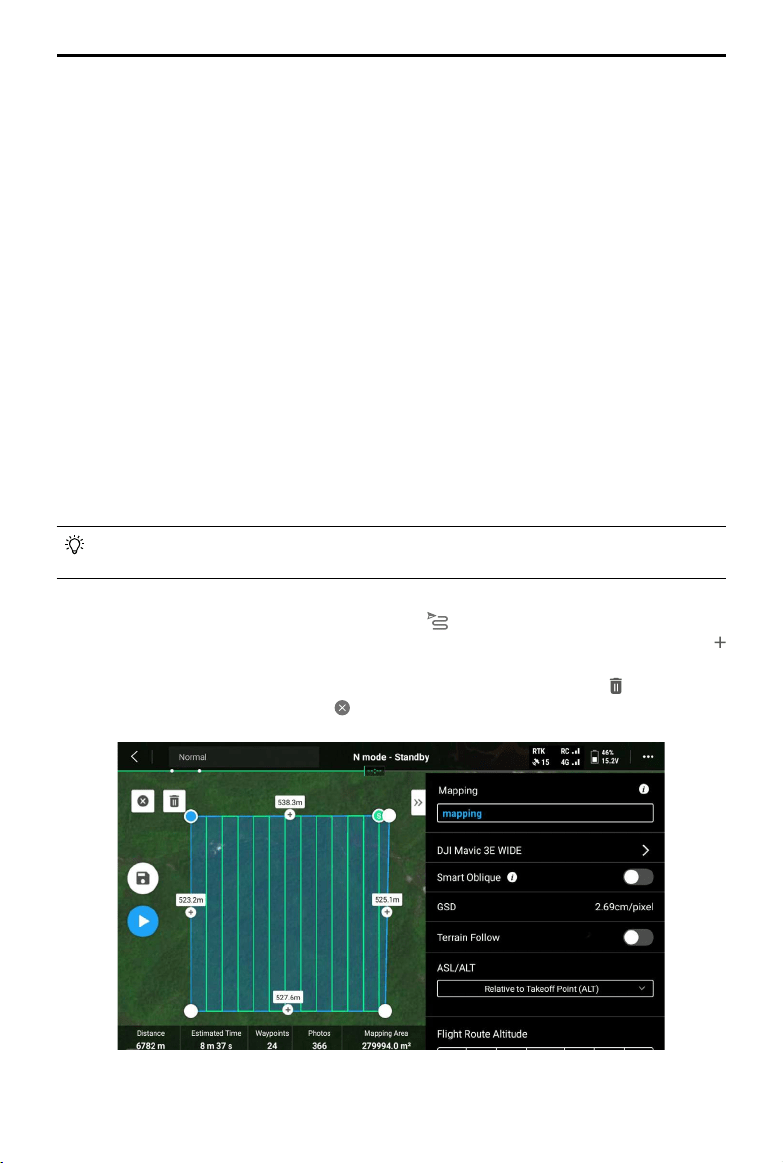
1. Tap on the home screen of DJI Pilot 2 to enter the flight route library, select Create a
Route or Import Route (KMZ/KML), and select
to create a mapping task. Tap on the
map view, and drag the boundary point to adjust the range of the mapping area. Tap
in the middle of the boundary point to add a boundary point, and adjust the longitude
and latitude of the point in the parameter settings on the right. Tap to delete the
selected boundary point, and click to delete all boundary points.
Loading ...
Loading ...
Loading ...