Loading ...
Loading ...
Loading ...
10
Quick Reference Guide
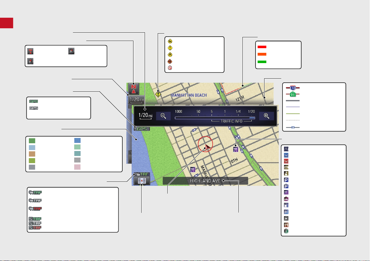
Map Screen Legend
Park
Hospital
Golf Course
Body of water
Cemetery
University
Airport
Industrial complex
Feature areas
Traffic status indicator* (P109)
Map orientation (P54)
GPS signal strength
North up
Heading up
Best reception
Good reception
No icon: Poor/No reception
Traffic information available
Flow or incident data not available
Traffic information not available
Traffic information off or map
scale too large
Current map scale
Current street name
Map menu (P105 )
Map scale (P58)
Current vehicle position (P62)
Streets
Landmark icons (P59)
Shopping Mall
Freeways
State routes
Road
Unverified road
One-way streets
Acura dealer
Honda dealer (U.S.)
ATM
School
Parking lot
Parking garage
Grocery store
Hotel/Lodging
Gas station
Hospital
Post office
Restaurant
Freeway exit information
Congestion
Incident
Weather
Construction
Road Closed/Blocked
Traffic incident icons* (P109)
Traffic flow indicator* (P109 )
Heavy
Moderate
Free flow
3D map
Honda dealer (Canada)
*: Traffic is only available in certain areas.
Military Base
Pedestrian street
State line
17 FIT NAVI-31T5A8200.book 10 ページ 2016年5月13日 金曜日 午前11時49分
Loading ...
Loading ...
Loading ...