
Loading ...
Loading ...
Loading ...
38
©
2020 DJI All Rights Reserved.
AGRAS T16
User Manual
89
%
1
67
%
2
99%
3.2 76
43.2
5M
10M
15M
N
S
W
E
12
RTK
Route (GNSS)
Field Area Height
Operation Efficiency
HA M
10m
DISTANCE
10.0M
HEIGHT
10.0M
FLOW
1.6L/MIN
VERTICAL VELOCITY
0.0M/S
REMAINING PESTICIDE
6.6L
HORIZONTAL VELOCITY
3.3M/S
Perform
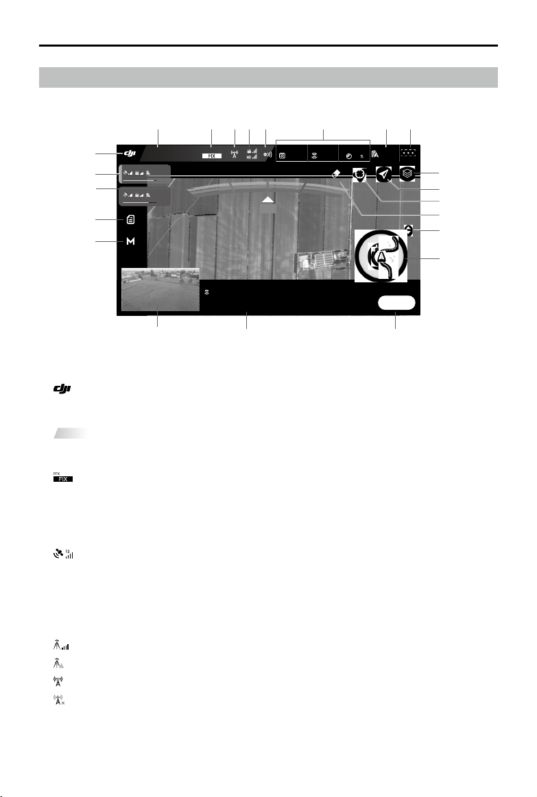
Operation View
1. Home Screen
: Tap this icon to return to the home screen.
2. System Status
Route (GNSS)
: Indicates current flight modes, operation modes, and warning messages.
3. RTK/GNSS Signal Strength
12
: This icon is be displayed when RTK is enabled and works normally. On the left upper corner
is the number of satellites connected. One of the following two icons is displayed below the RTK
icon: FIX indicates that the differential data calculation is completed and the aircraft can use RTK for
positioning. The aircraft can only take off in this status. FLOAT indicates that the system is calculating
the differential data. Wait for FIX to be displayed.
: This icon is displayed when RTK is not in use. It shows the current GNSS signal strength and
the number of satellites connected.
4. RTK Status
Icons displayed when using RTK data. The display varies when using the D-RTK 2 or Network RTK
Service.
: Displays RTK signal strength when using the D-RTK 2.
: Indicates that the connection with the D-RTK 2 is abnormal. Refer to the prompts in the app.
: Displays RTK signal strength when using the Network RTK Service.
: Indicates that the connection with the Network RTK server is abnormal. Refer to the prompts in
the app.
1
19
20
22
21
1718 16
10
14
15
11
12
13
2 3 654 7 8 9
Loading ...
Loading ...
Loading ...