Loading ...
Loading ...
Loading ...
DJI Mavic 3E/3T User Manual
78
©
2022 DJI All Rights Reserved.
b. The aircraft will automatically adjust the flight speed according to the number of photos
required to ensure operational efficiency.
Photo Number 1 2 3
Flight Speed Fast Medium Slow
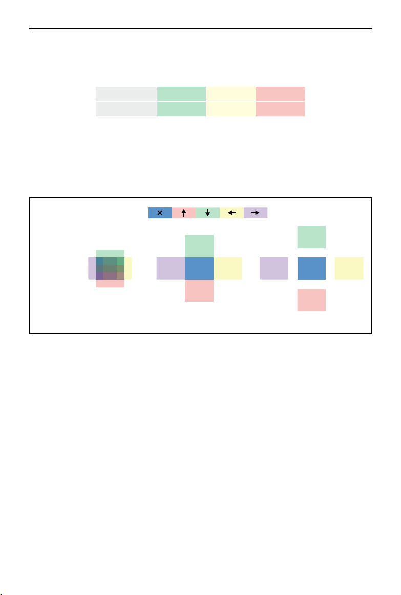
c. The flight area will vary depending on the mapping area, flight altitude, and gimbal pitch.
The flight area will also vary when the mapping area is the same, but the flight altitude
or gimbal pitch varies.
Shooting Direction
The First Flight Route
The First Flight Route
The First Flight Route
Mapping
Area
Mapping
Area
Mapping
Area
The Second
Flight Route
Terrain Follow
When collecting data in areas with large elevation differences, such as mountainous areas,
Terrain Follow allows the aircraft to adjust the flight altitude following the changes in the
terrain. Terrain Follow ensures that the relative height of the aircraft and the ground below
remains unchanged so that the Ground Sampling Distance (GSD) of the photos collected in
each area is consistent, improving the accuracy of mapping data while ensuring flight safety.
Real-Time Follow
Real-Time Follow does not require DSM files. The aircraft vision system detects the terrain
fluctuations 200 m ahead in real time during the flight. It is recommended to use this
function in areas where the terrain slope is less than 75° and the lighting condition and
environment are suitable for the vision system.
Loading ...
Loading ...
Loading ...