Loading ...
Loading ...
Loading ...
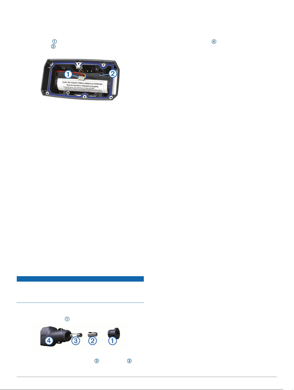
small Phillips screwdriver. You may need a small flat
screwdriver.
1
Install the new battery using the same orientation as the old
battery.
The connector should face the end nearest the power key,
and the bump where the wires connect to the battery
should face toward the side with the charging clip contacts.
2
Replace the battery cover.
3
Replace the screws to secure the battery cover.
4
Connect the battery connector and power connector.
You may need to use a flat screwdriver to help secure the
connectors.
5
Select the power key to test the connections.
When properly connected, a tone is emitted and the status
LED blinks green.
6
Turn off the device.
7
Verify the gasket located inside the bottom cover is fully
seated.
8
Replace the back plate.
9
Replace the six screws to secure the back plate.
After you install the new battery, charge the collar completely.
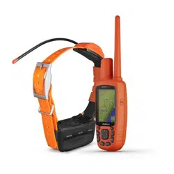
Replacing the Collar Strap
Before you replace the collar strap, you must remove all dirt,
water, and debris from the device (Cleaning the Device,
page 11).
1
Pull the collar strap out of the GPS antenna, antenna guide,
and the dog device.
You may need to push and pull the collar strap to properly
remove it. You may need to loosen the screw on the GPS
antenna case, but do not remove them.
2
Thread the new collar strap through the dog device, antenna
guide, and GPS antenna.
3
If necessary, tighten the screws that secure the GPS antenna
case.
Changing the Fuse in the Vehicle Power Cable
NOTICE
When replacing the fuse, do not lose any of the small pieces
and make sure they are put back in the proper position. The
vehicle power cable does not work unless it is assembled
correctly.
If your device does not charge in your vehicle, you may need to
replace the fuse located at the tip of the vehicle adapter.
1
Rotate the end piece counter clockwise to unlock it.
TIP: You may need to use a coin to remove the end piece.
2
Remove the end piece, the silver tip , and the fuse .
3
Insert a new fast-blow fuse that has the same current, such
as 1 A or 2 A.
4
Place the silver tip in the end piece.
5
Push in the end piece and rotate it clockwise to lock it back
into the vehicle power cable .
Data Fields
Accuracy of GPS: The margin of error for your exact location.
For example, your GPS location is accurate to within +/- 12 ft.
(3.65 m).
Ambient Pressure: The uncalibrated environmental pressure.
Ascent - Average: The average vertical distance of ascent
since the last reset.
Ascent - Maximum: The maximum rate of ascent in feet per
minute or meters per minute since the last reset.
Ascent - Total: The total elevation distance ascended since the
last reset.
Barometer: The calibrated current pressure.
Battery Level: The remaining battery power.
Bearing: The direction from your current location to a
destination. You must be navigating for this data to appear.
Cadence: The number of revolutions of the crank arm or
number of strides per minute. Your device must be
connected to a cadence accessory for this data to appear.
Course: The direction from your starting location to a
destination. Course can be viewed as a planned or set route.
You must be navigating for this data to appear.
Descent - Average: The average vertical distance of descent
since the last reset.
Descent - Maximum: The maximum rate of descent in feet per
minute or meters per minute since the last reset.
Descent - Total: The total elevation distance descended since
the last reset.
Distance to Dest.: The remaining distance to the final
destination. You must be navigating for this data to appear.
Distance to Next: The remaining distance to the next waypoint
on the route. You must be navigating for this data to appear.
Elevation: The altitude of your current location above or below
sea level.
Elevation - Maximum: The highest elevation reached since the
last reset.
Elevation - Minimum: The lowest elevation reached since the
last reset.
ETA at Destination: The estimated time of day when you will
reach the final destination (adjusted to the local time of the
destination). You must be navigating for this data to appear.
ETA at Next: The estimated time of day when you will reach the
next waypoint on the route (adjusted to the local time of the
waypoint). You must be navigating for this data to appear.
Glide Ratio: The ratio of horizontal distance traveled to the
change in vertical distance.
Glide Ratio to Dest: The glide ratio required to descend from
your current position to the destination elevation. You must
be navigating for this data to appear.
GPS Signal Strength: The strength of the GPS satellite signal.
Heading: The direction you are moving.
Heart Rate: Your heart rate in beats per minute (bpm). Your
device must be connected to a compatible heart rate monitor.
Location (lat/lon): The current position in latitude and longitude
regardless of the selected position format setting.
Location (selected): The current position using the selected
position format setting.
14 Appendix
Loading ...
Loading ...
Loading ...