Loading ...
Loading ...
Loading ...
Tides
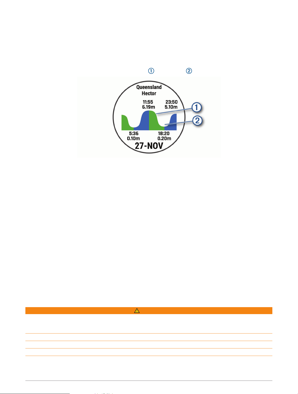
Viewing the Tide Data
When you pair your device with a smartphone, you can download up to seven days of tide data for your current
location. You can update your location and download new tide data by selecting START from the tide screen.
1 From the watch face, select START > Tides.
A 24-hour tide chart appears, showing the high tides and low tides for the current date.
2 Select UP or DOWN to view the tide data from other days.
Anchor
Marking Your Anchor Location
1 From the watch face, select START > Anchor.
2 Select START > Drop Anchor.
Anchor Settings
Select START > Anchor > START.
Drift Radius: Sets the allowable drift distance while anchored.
Update interval: Sets the time interval for updating anchor data.
Anchor Assist Settings
From the anchor assist screen, select START.
Scope: Sets the first number in the anchor scope ratio. The ratio is the length of anchor rode in use to the
vertical distance from the bow of the boat to the bottom of the water.
Depth: Sets the depth of the water.
Bow Offset: Sets the distance between the bow of your boat and the location of your GPS antenna.
Autopilot
WARNING
You are responsible for the safe and prudent operation of your vessel. The autopilot is a tool that enhances your
capability to operate your boat. It does not relieve you of the responsibility of safely operating your boat. Avoid
navigational hazards and never leave the helm unattended.
Always be prepared to promptly regain manual control of your boat.
Learn to operate the autopilot on calm and hazard-free open water.
Use caution when operating the autopilot near hazards in the water, such as docks, pilings, and other boats.
Marine Activities 7
Loading ...
Loading ...
Loading ...