Loading ...
Loading ...
Loading ...
224
Acquiring GPS Signals
1
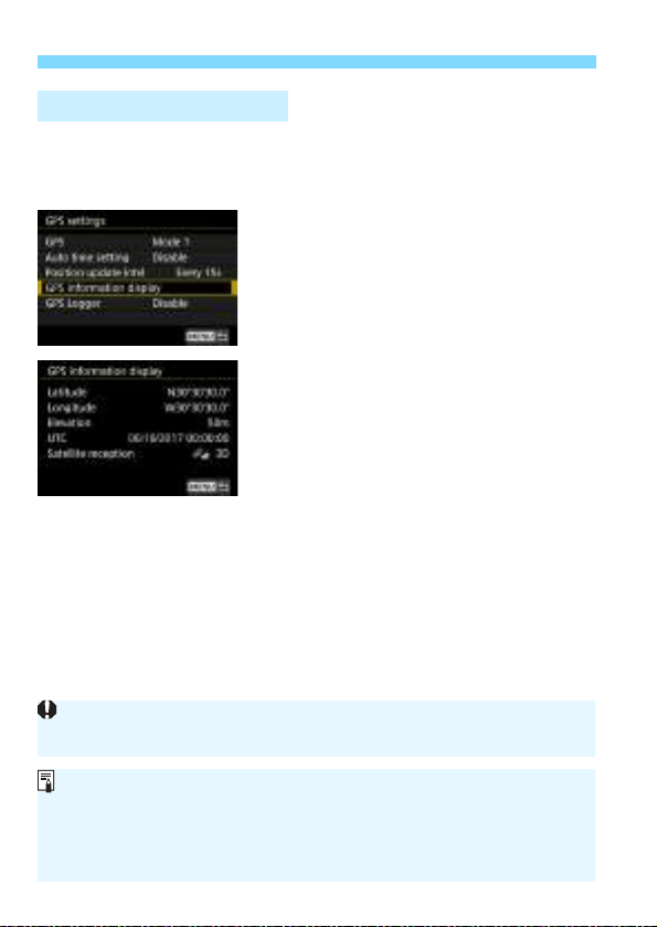
Check the [GPS] setting.
Check that [GPS] is set to [Mode 1]
or [Mode 2].
2
Select [GPS information display].
X The GPS information will be
displayed.
3
Take the picture.
When you shoot after GPS signal
acquisition, the image will be
geotagged.
Viewing GPS Information
Generally, elevation is not as accurate as latitude and longitude due to the
nature of GPS.
The <A> icon indicates signal conditions. When <C> is displayed, the
elevation is also recorded. Note that the elevation cannot be recorded
when <B> is displayed.
UTC (Coordinated Universal Time) is essentially the same as Greenwich
Mean Time.
Loading ...
Loading ...
Loading ...