Loading ...
Loading ...
Loading ...
NAVIGATION
Your navigation system is comprised of two
main features, destination mode and map
mode.
Map Mode
Map mode shows advanced viewing
comprised of 2D city maps, 3D landmarks
and 3D city models (when available). 2D city
maps show detailed outlines of buildings,
visible land use, landscape features, and
detailed railroad infrastructure for the most
essential cities around the globe.
3D landmarks appear as clear, visible objects
that are typically recognizable and have a
certain tourism value.
3D city models are complete 3D models of
entire city areas including navigable roads,
parks, rivers and rendered buildings. 3D
landmarks and city models appear in 3D map
mode only. Coverage of these varies and
improves with updated map releases.
E207752
Select the zoom in icon to see a
closer view of the map.
E207753
Select the zoom out icon to see a
farther away view of the map.
You can adjust the view in preset increments.
You can also pinch to zoom in or out of the
map.
The information bar tells you the names of
streets, cities or landmarks as you hover over
them with the crosshair curser.
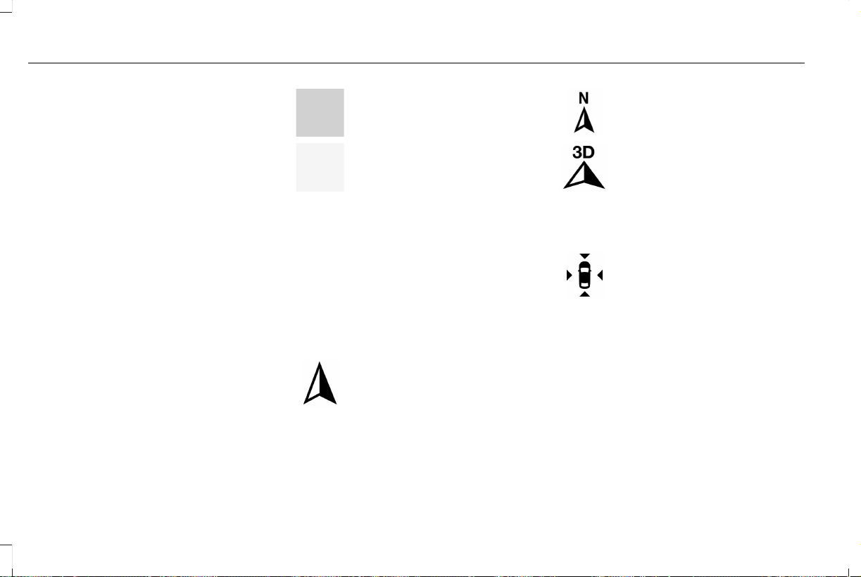
You can change your view of the map by
tapping on the location indicator icon on the
right hand side of the screen. You can
choose from the following options:
E207750
Heading up (2D map) This always
shows the direction of forward
travel to be upward on the screen.
This view is available for map
scales up to 3 mi (5 km).
E207749
North up (2D map) always shows
the northern direction to be
upward on the screen.
E207748
3D map mode provides an
elevated perspective of the map.
Adjust this viewing angle and
rotate the map 180 degrees by
touching the map twice, and then dragging
your finger along the shaded bar with arrows
at the bottom of the map.
E207751
Re-center the map by pressing this
icon whenever you scroll the map
away from your vehicle’s current
location.
E207754
Points of Interest (POI) grouping
icon: You can choose up to three
POI icons to display on the map. If
the chosen POIs are located close
together or are at the same location a box is
used to display a single category icon
404
Navigator (TB5) Canada/United States of America, enUSA, First Printing
SYNC™ 3
Loading ...
Loading ...
Loading ...