Loading ...
Loading ...
Loading ...
©
2023 DJI All Rights Reserved.
41
DJI MINI 2 SE User Manual
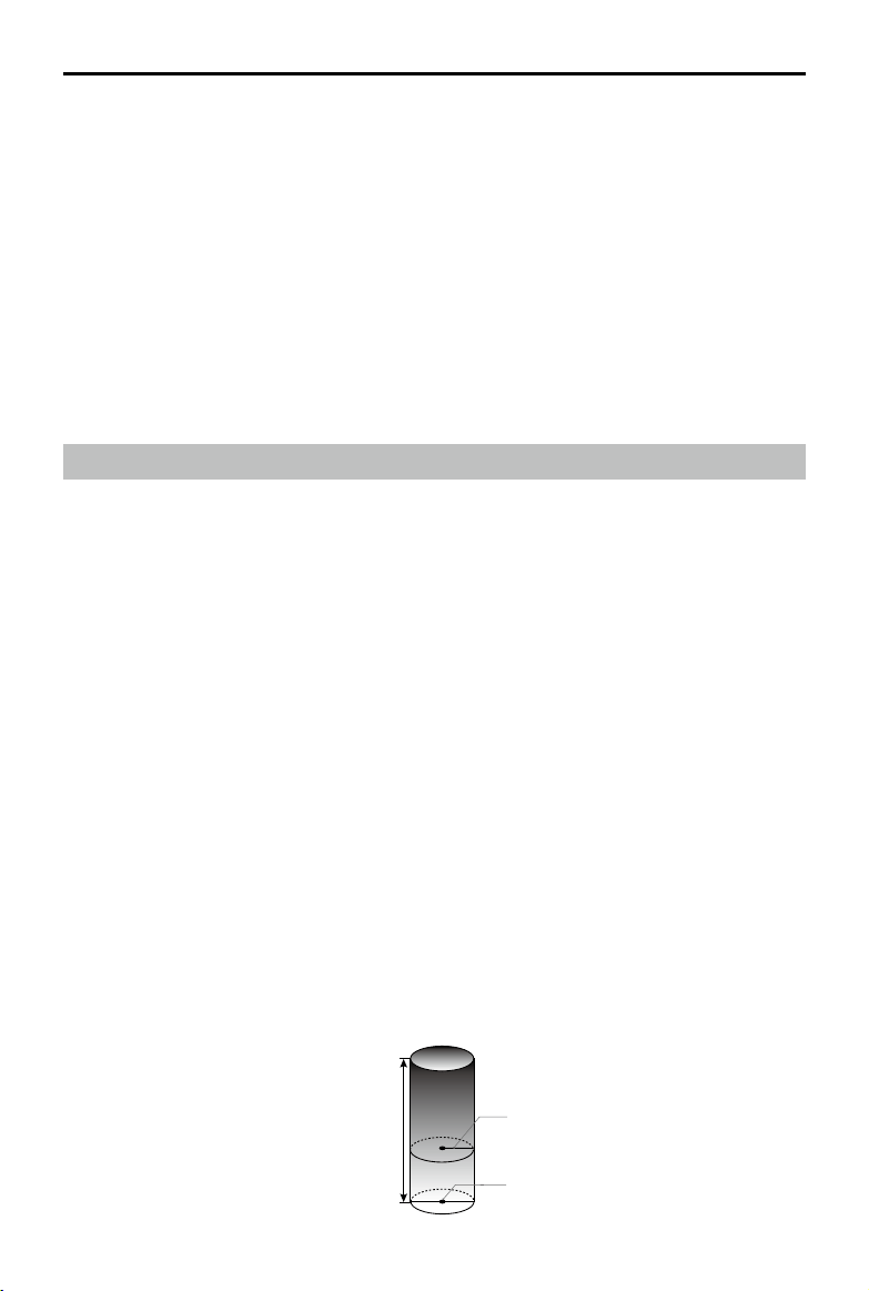
Max Flight Altitude
Max Radius
Home Point
Height of aircraft
when powered on
4. DO NOT use an aircraft that has been crashed or accidentally damaged or an aircraft that is not in
good condition.
5. Make sure you have been suciently trained and have contingency plans for emergency situations or
for when accidents occur.
6. Make sure you have a ight plan and never y the aircraft recklessly.
7. Respect the privacy of others when using the camera. Make sure you comply with local privacy laws,
regulations, and moral standards.
8. DO NOT use this product for any reason other than general personal use. DO NOT use it for any
illegal or inappropriate purpose (such as spying, military operations, or unauthorized investigations).
9. DO NOT use this product to defame, abuse, harass, stalk, threaten, or otherwise violate the legal
rights (such as the right of privacy and publicity) of others.
10. DO NOT trespass onto the private property of others.
Flight Limits and GEO Zones
GEO (Geospatial Environment Online) System
DJI's Geospatial Environment Online (GEO) System is a global information system that provides real-time
information on ight safety and restriction updates and prevents UAVs from ying in restrict airspace.
Under exceptional circumstances, restricted areas can be unlocked to allow ights in. Prior to that, the
user must submit an unlocking request based on the current restriction level in the intended ight area.
The GEO system may not fully comply with local laws and regulations, users shall be responsible for
their own ight safety and must consult with the local authorities on the relevant legal and regulatory
requirements before requesting to unlock a ight in a restricted area. For more information about the
GEO system, visit http://www.dji.com/ysafe.
Flight Limits
Unmanned aerial vehicle (UAV) operators should abide by the regulations from self-regulatory
organizations such as the International Civil Aviation Organization, the Federal Aviation Administration,
and local aviation authorities. For safety reasons, flight limits are enabled by default to help users
operate this aircraft safely and legally. Users can set ight limits on height and distance.
Altitude limits, distance limits, and GEO zones function concurrently to manage ight safety when GPS
is available. Only altitude can be limited when GPS is unavailable.
Flight Altitude and Distance Limits
The ight altitude and distance limits can be changed in DJI Fly. Based on these settings, the aircraft will
y in a restricted cylinder as shown below:
Loading ...
Loading ...
Loading ...