
Loading ...
Loading ...
Loading ...
Laylines Settings
To use the laylines features, you must connect a wind sensor to the chartplotter.
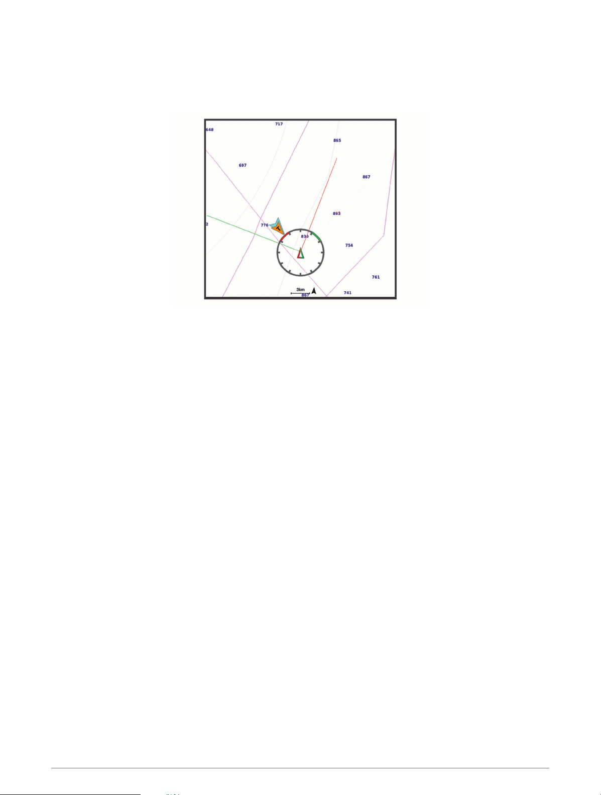
When in sailing mode (Setting the Vessel Type, page6), you can display laylines on the navigation chart. Laylines
can be very helpful when racing.
From the Navigation chart, select Menu > Layers > My Vessel > Laylines.
Mark: Sets how the laylines appear on the chart.
Vessel: Sets how the vessel appears on the chart.
Length: Sets the length of the laylines.
Display: Sets how the laylines and vessel appear on the chart.
Setup > Sailing Angle: Allows you to select how the device calculates laylines. The Actual option calculates
the laylines using the measured wind angle from the wind sensor. The Manual option calculates the laylines
using manually entered windward and leeward angles.
Setup > Windward Angle: Allows you to set a layline based on the windward sailing angle.
Setup > Leeward Angle: Allows you to set a layline based on the leeward sailing angle.
Setup > Tide Correction: Corrects the laylines based on the tide.
Setup > Filter Time Constant: Filters the layline data based on the time interval entered. For a smoother layline
that filters out some of the changes in the boat's heading or true wind angle, enter a higher number. For
laylines that display a higher sensitivity to changes in the boat's heading or true wind angle, enter a lower
number.
User Data Layer Settings
You can show user data, such as waypoints, boundaries, and tracks, on the charts.
From a chart, select Menu > Layers > User Data.
Waypoints: Shows waypoints on the chart and opens the list of waypoints.
Boundaries: Shows boundaries on the chart and opens the list of boundaries.
Tracks: Shows tracks on the chart.
Other Vessels Layer Settings
NOTE: These options require connected accessories, such as an AIS receiver or VHF radio.
From a chart, select Menu > Layers > Other Vessels.
DSC: Sets how DSC vessels and trails appear on the chart, and shows the DSC list.
AIS: Sets how AIS vessels and trails appear on the chart, and shows the AIS list.
Details: Shows other vessel details on the chart.
Projected Heading: Sets the projected heading time for AIS-activated vessels.
AIS Alarm: Sets the safe-zone collision alarm (
Setting the Safe-Zone Collision Alarm, page19).
Charts and 3D Chart Views 23
Loading ...
Loading ...
Loading ...