Loading ...
Loading ...
Loading ...
Setting the Sailing Units
1 From the watch face, select START > Sail Race.
2 Hold MENU.
3 Select the activity settings.
4 Select Nautical Units.
5 Select an option:
• To use nautical units for speed and distance, select On.
• To use the system units of measure for speed and distance, select Use Sys. Settings.
Tides
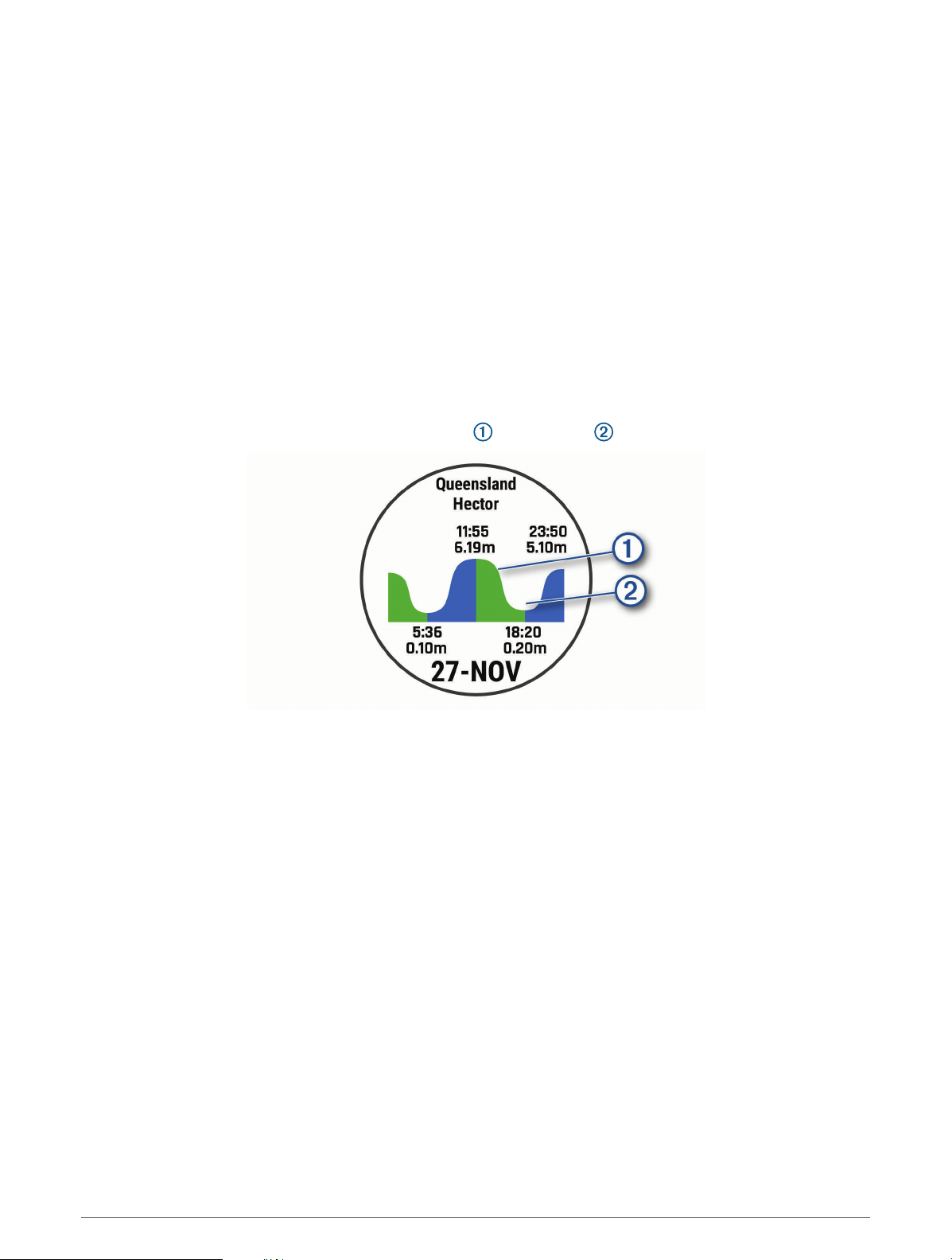
Viewing the Tide Data
When you pair your device with a smartphone, you can download up to seven days of tide data for your current
location. You can update your location and download new tide data by selecting START from the tide screen.
1 From the watch face, select START > Tides.
A 24-hour tide chart appears, showing the high tides and low tides for the current date.
2 Select UP or DOWN to view the tide data from other days.
Anchor
Marking Your Anchor Location
1 From the watch face, select START > Anchor.
2 Select START > Drop Anchor.
Anchor Settings
Select START > Anchor > START.
Drift Radius: Sets the allowable drift distance while anchored.
Update interval: Sets the time interval for updating anchor data.
Anchor Assist Settings
From the anchor assist screen, select START.
Scope: Sets the first number in the anchor scope ratio. The ratio is the length of anchor rode in use to the
vertical distance from the bow of the boat to the bottom of the water.
Depth: Sets the depth of the water.
Bow Offset: Sets the distance between the bow of your boat and the location of your GPS antenna.
Marine Activities 7
Loading ...
Loading ...
Loading ...