
Loading ...
Loading ...
Loading ...
Viewing Waypoint Information
You can view information about a location from the list of nearest airports, list of aviation waypoints, or list of
waypoints in a flight plan.
1 Select an option to view a list of waypoints:
• To view a list of the nearest airports, hold BACK (Navigating to the Nearest Airport, page 6).
• To view a list of aviation waypoints, hold START, and enter all or part of the alphanumeric identifier
(Navigating to an Aviation Waypoint by Its Identifier, page 7).
• To find a waypoint, select START > FLY, hold MENU, select Navigation > Flight Planning > Find Waypoint,
and select an option (Finding a Waypoint, page 9).
2 Select a waypoint.
3 Select an option:
NOTE: Options vary by the selected waypoint type.
• To navigate directly to the selected location, select Direct-To.
• To download the NEXRAD weather radar image associated with the selected location, select NEXRAD
(Viewing NEXRAD Weather Radar, page 5).
• To show the waypoint on the map, select Show Map.
• To view general information, such as the distance and bearing from your current location, select General
Info.
• To show radio frequencies, select Frequencies.
• To show runway information, such as the runway length and surface material, select Runways.
• To show METAR and TAF information, select METARs/TAFs.
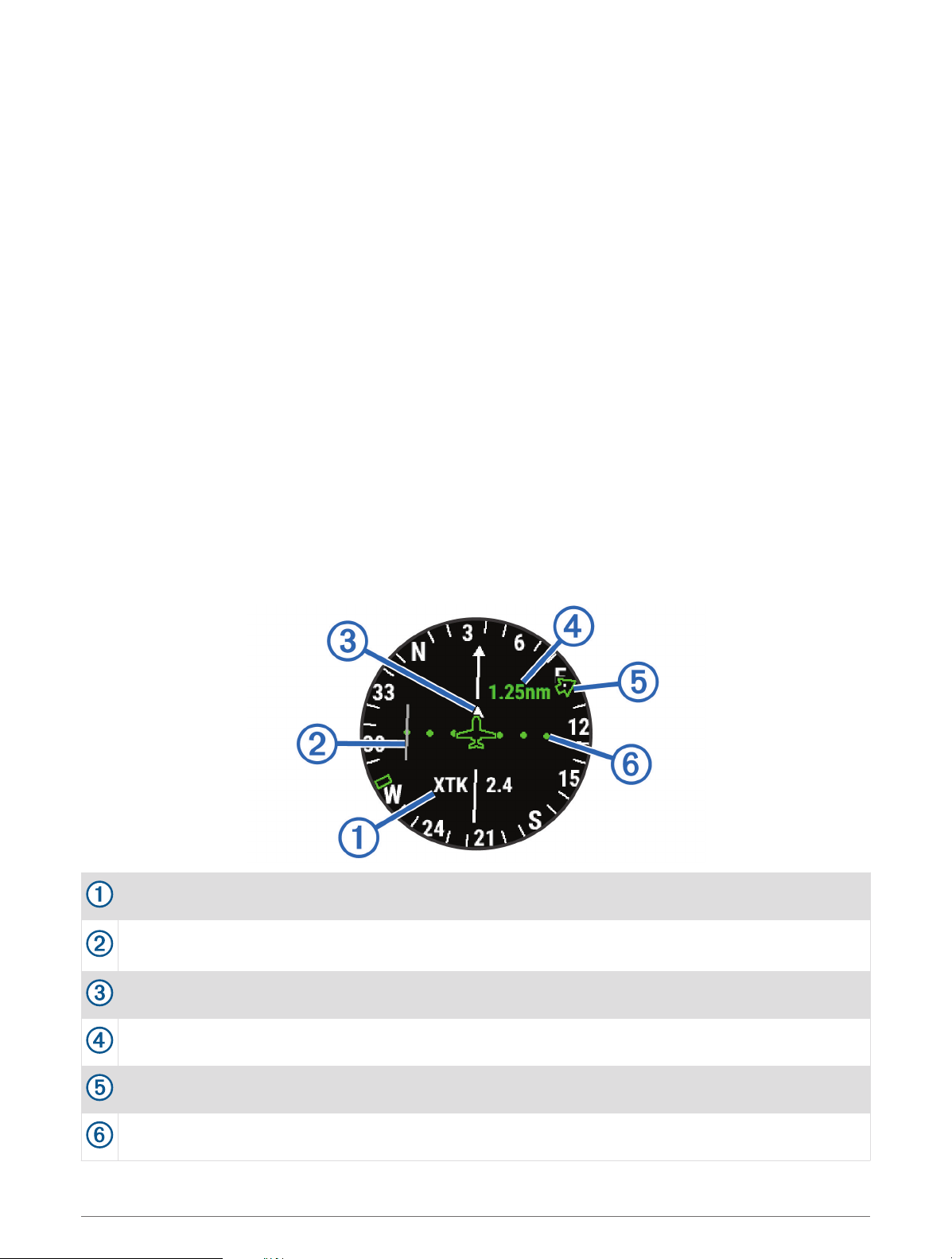
Horizontal Situation Indicator
Configurable navigation data field.
Course deviation indicator (CDI). Indicates the location of the desired course line in relation to your
location.
To-and-from indicator. Indicates whether you are headed toward or away from the waypoint.
Course deviation distance scale.
Bearing to the nearest airport.
Course deviation distance. The dots indicate your distance off course.
8 Flying
Loading ...
Loading ...
Loading ...