Loading ...
Loading ...
Loading ...
48 Navigation System
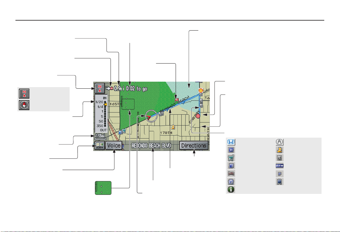
Driving to Your Destination
Acura Dealer
School
Restaurant
AT M
Parking Lot
Post Office
Honda Dealer
Hospital
Grocery Store
Gas Station
Hotel/Lodging
Parking Garage
Freeway Exit Information
Map Screen Legend
Map Orientation
(see page 53)
Map Scale Adjustment
(Mile or km per half inch
appears only when you
ZOOM IN or OUT.)
(see page 52)
Current Map Scale
(see page 52)
ICON Button
(see page 56)
“Breadcrumbs”
(see Off-road Tracking on page 58)
NOTE:
See Map Legend from the Information screen for further
explanation (see page 69).
Direction of Destination
(When on route)
(see page 50)
Voice (see page 47)
(Announces next driving instruction)
Distance to Destination
(see page 50)
Time to Destination
(see page 50)
Waypoint
(When on route)
(see page 61)
Current Street (see page 6)
Vehicle Position (see page 59)
(Use voice command, “Display current location,” or
touch the icon to show the current location.)
Direction List
(see page 50)
Blue Line
Calculated route (see page 46)
Map Features
Dark Green: Park Light Blue: Hospital
Brown: Shopping Mall Light Brown: Indian Reservation
Green: Golf Course Gray: Airport/Stadium/Business
Blue: Body of Water Blue/Green: Cemetery
Matte Blue: University
NOTE:
If you move the joystick over an area (map features shown
above), the name is displayed on the screen.
Destination Icon
(see page 54)
Streets
(see Map Overview on page 6, or
Unverified Area Routing on page 82)
Red: Interstates or Freeways
Black: Verified Street
Light Brown: Unverified Street
Landmark Icon (see page 54)
“North Up”
“Heading Up”
2008 Pilot
Main Menu
Loading ...
Loading ...
Loading ...