Loading ...
Loading ...
Loading ...
66 Navigation System
PILOT KA 31SZA830
Driving to Your Destination
Map Scale
Rotate the Interface Dial knob or a voice command such as “Display 1/2 mile scale” (see page 158) to change the scale of the
map. Zooming in increases the detail, while zooming out gives you a view of a wider area. After changing the scale, give the
system a few moments to update the display.
Functions available at various map scales
NOTE:
• You can change between miles or kilometers in SETUP (see Units on page 99).
• For information on the available voice commands, see Voice Command Index on page 157.
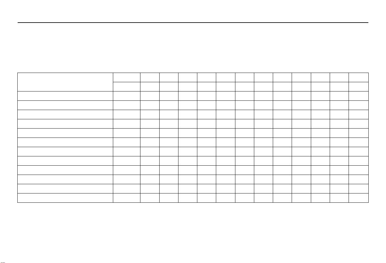
Map Scale (English and Metric)
For selecting units, see page 99.
1/20 mi. 1/8 mi. 1/4 mi. 1/2 mi. 1 mi. 2 mi. 5 mi. 15 mi. 50 mi. 150 mi. 350 mi.
1000 mi.
80 m 200 m 400 m 800 m 1.6 km 3 km 8 km 24 km 80 km 240 km 560 km 1600 km
POI icon symbols (like ATM) page 67 XX
Breadcrumbs (off-road tracking dots)
page 70 XXXX
Freeway exit information icons page 67 XXX
One-way traffic icon page 67 X
Unverified road display (purple)
page 6 XXX
Map orientation “Heading-up” page 63 XXXXX
Map orientation “North-up” page 63 XXXXXXXXXXXX
Map features (park, golf course, etc.) page 56 XXXXXXXXXXX
Avoid area shown on map page 105 XXX
Avoid area scales (when creating) page 105 XXX
Waypoint “flag” icons page 75 XXXXXXXXXXXX
Traffic speed / incident page 22 XXXXXXX
00 PILOT_KA-31SZA830.book 66 ページ 2011年7月24日 日曜日 午後5時14分
Loading ...
Loading ...
Loading ...