Loading ...
Loading ...
Loading ...

9
may be helpful to have a friend hold the flashlight while you
look through the polar finder.
For most accurate polar alignment, you will need to know the
approximate longitude of your observing site.This information
can be obtained by looking at a local map. Now, you must fig-
ure the difference between the longitude of your observing
site and the closest standard time meridian. The standard
time meridians are 75°, 90°, 105°, and 120° for the 48 conti-
nental states (150° and 165° for Hawaii and Alaska). Choose
the standard time meridian that is closest in value to your
local longitude, and then calculate the difference.
If your local longitude has a value less than the closest stan-
dard time meridian, then you are east of the standard time
meridian by the calculated amount.If your local longitude has
a value greater than the closest standard time meridian, then
you are west of the standard time meridian by the calculated
amount. For example, if you are in Las Vegas, which has a
longitude of 115°, then the closest standard time meridian is
120°.The difference between these two numbers is 5°. Since
Las Vegas’ longitude value is less than the standard time
meridian value, you are 5° east of the closest time meridian.
Take your calculated difference from the closest standard
time meridian and rotate the date circle so that the meridian
offset scale line that corresponds to your calculated differ-
ence lines up with the engraved time meridian indicator mark
on the polar finder housing. Each line of the meridian offset
scale represents 5° of longitude. Lines to the left of the “0” on
the meridian offset scale indicate east of the closest standard
time meridian, while lines to the right of the “0” indicate west
of the closest standard time meridian.
Continuing with the prior example of observing in Las Vegas,
you would rotate the date circle so that the first line to the left
of the “0” on the meridian offset scale lines up with the time
meridian indicator mark.
Make sure that the “0” mark on the R.A. setting circle lines up
with the pointed indicator cast into the mount, and that the
large thumbscrew just above it is tightened. Now, rotate the
mount about the R.A.axis until the line on the R.A. setting cir-
cle that corresponds to your current local time lines up with
the line on the date circle that indicates the current date.If you
are on daylight savings time, subtract one hour from your cur-
rent local time.
For example, if it was November 1 at 9 PM, standard time,
you would rotate the telescope in R.A. until the line above the
“21” (9 P.M.) on the R.A. setting circle lines up with the long
line between the “10” and “11” on the date circle.The long line
indicates the first day of the higher numbered month, i.e. the
line between “10” and “11” marks November 1st.
Finally, look through the polar alignment finder scope while
shining a red flashlight at an angle down the front opening of
the R.A. axis, and center Polaris in the small circle. Adjust the
tilt of the altitude up-or-down with the latitude adjustment T-
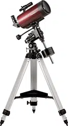
bolts and use the azimuth fine adjustment knobs (Figure 8) for
final positioning.To do this, you will first need to loosen the big
tripod attachment knob directly underneath the base of the
equatorial mount.The fine adjustment knobs work by loosen-
ing one and then tightening the other.When done, retighten the
tripod attachment knob to firmly secure the mount and tripod. If
the fine adjustment knobs do not allow the mount to move far
enough to center Polaris, you will need to rotate the entire tri-
pod left or right to get it within the fine adjustment’s range.
Once Polaris is centered in the small circle, you are done.The
telescope is now accurately polar aligned, and can be used
for advanced observational applications, such as astropho-
tography or precise use of the manual setting circles. As
mentioned before, only move the telescope along the R.A.
and Dec. axes; if you move the tripod, or change the tilt of the
equatorial mount, you will need to polar align again.
Remember, accurate polar alignment is not needed for casu-
al visual observing. Most of the time, approximate polar
alignment, as outlined previously, will suffice.
Use of the R.A. and Dec.
Slow-Motion Control Cables
The R.A. and Dec. slow-motion control cables allow fine
adjustment of the telescope’s position to center objects within
the field of view. Before you can use the cables, you must
manually “slew” the mount to point the telescope in the vicini-
ty of the desired target. Do this by loosening the R.A. and
Dec. lock levers and moving the telescope about the mount’s
R.A. and Dec. axes. Once the telescope is pointed some-
where close to the object to be viewed, retighten the mount’s
R.A. and Dec. lock levers.
The object should now be visible somewhere in the tele-
scope’s finder scope.If it isn’t, use the slow-motion controls to
scan the surrounding area of sky.When the object is visible in
the finder scope, use the slow-motion controls to center it.
Now, look in the telescope’s eyepiece. If the finder scope is
properly aligned, the object should be visible somewhere in
the field of view.Once the object is visible in the eyepiece, use
the slow-motion controls to center it in the field of view.
Tracking Celestial Objects
When you observe a celestial object through the telescope,
you’ll see it drift slowly across the field of view. To keep it in
the field, if your equatorial mount is polar aligned, just turn the
R.A. slow-motion control cable clockwise. The Dec. slow-
motion control cable is not needed for tracking. Objects will
appear to move faster at higher magnifications, because the
field of view is narrower.
Optional Motor Drives for Automatic Tracking
An optional DC motor drive can be mounted on the R.A. axis
of the equatorial mount to provide hands-free tracking.
Objects will then remain stationary in the field of view without
any manual adjustment of the R.A.slow-motion control cable.
Understanding the Setting Circles
The setting circles on an equatorial mount enable you to
locate celestial objects by their “celestial coordinates”. Every
object resides in a specific location on the “celestial sphere”.
That location is denoted by two numbers: its right ascension
(R.A.) and declination (Dec.). In the same way, every location
Loading ...
Loading ...
Loading ...