Loading ...
Loading ...
Loading ...
Destination guidance
160
3. Select "Traffic Info" and press the control-
ler.
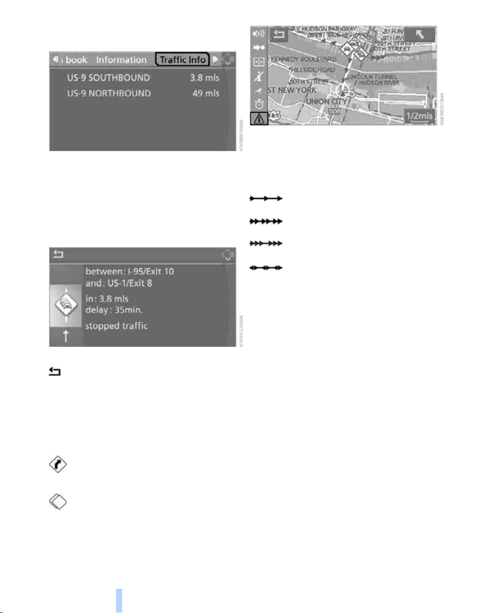
First the traffic information along the planned
route is shown sorted according to the distance
to the current vehicle position.
Displaying detailed traffic information
Select a traffic information item from the list and
press the controller.
To exit from the menu:
Select the arrow and press the controller.
Depiction of traffic information in map
view
The traffic information symbols are shown in
the map view up to a scale of 100 miles/200 km.
With a scale of up to 5 miles/10 km, additional
information is displayed. The length, direction
and effect of a traffic obstruction are indicated
with arrows along the route, e.g.
Along planned route
Colored symbol with the traffic obstruction
symbol.
Outside planned route
> Map scale up to 5 miles/10 km:
White symbol with black or gray border with
the traffic obstruction symbol
> Map scale from 10 miles/20 km:
White symbol with black border and an
arrow in the direction concerned
Traffic event with map scales greater
than 5miles/10km, arrow points in
the direction of travel concerned.
Several traffic events have been
received. Select a smaller scale to
display these individually.
Slow traffic or other event
Traffic back up
Stopped traffic
Traffic event in both directions of
travel
Online Edition for Part no. 01 41 0 013 308 02/07 BMW AG
Loading ...
Loading ...
Loading ...